KwaZulu-Natal Midlands
For most travellers, the verdant farmland that makes up the Midlands is picture-postcard terrain, to be whizzed through on the two-hour journey from Durban or Pietermaritzburg to the Ukhahlamba Drakensberg. There’s little reason to dally here, unless you fancy taking in the region’s quaint, English-style country inns, tea shops and craft shops, several of which are on the so-called Midlands Meander, a route that weaves its way around the N3 on back roads between Pietermaritzburg and the Mooi River 60km to the northwest.
As you head north out of Pietermaritzburg on the N3 through the Midlands, you’re roughly tracing the last journey of Nelson Mandela as a free man before his arrest in 1962. On the run from the police, Mandela had been continuing his political activities, often travelling in disguise – a practice that earned him the nickname of the “Black Pimpernel”. Howick, 18km northwest of Pietermaritzburg, is recorded as the place where his historic detention began; the actual spot is on the R103, 2km north of a side road heading to the Tweedie junction. On this occasion, he was masquerading as the chauffeur of a white friend, when their car was stopped on the old Howick road, apparently because of a tip-off. A memorial unveiled by Mandela himself in 1996 marks the unassuming spot, amid farmland between a railway line and the road.
The Ukhahlamba Drakensberg
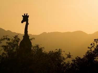
Hugging the border with Lesotho, South Africa’s premier mountain wilderness is mostly a vast national park officially known as the Ukhahlamba Drakensberg Park. The tallest range in Southern Africa, the “Dragon Mountains” (or, in Zulu, the “barrier of spears”) reach their highest peaks along the border with Lesotho. The range is actually an escarpment separating a high interior plateau from the coastal lowlands of KwaZulu-Natal. Although this is a continuation of the same escarpment that divides the Mpumalanga highveld from the game-rich lowveld of the Kruger National Park and continues into the northern section of the Eastern Cape, when people talk of the Berg, they invariably mean the range in KwaZulu-Natal.
For elating scenery – massive spires, rock buttresses, wide grasslands, glorious waterfalls, rivers, pools and fern-carpeted forests – the Ukhahlamba Drakensberg is unrivalled. Wild and unpopulated, it’s a paradise for hiking. One of the richest San rock-art repositories in the world, the Ukhahlamba Drakensberg is also a World Heritage Site, with more than six hundred recorded sites hidden all over the mountains (three easily accessible ones are at Giant’s Castle, Injisuthi and Kamberg), featuring more than 22,000 individual paintings by the original inhabitants of the area.
The park is hemmed in by rural African areas – former “homeland” territory, unsignposted and unnamed on many maps, but interesting to drive through for a slice of traditional Zulu life complete with beehive-shaped huts. Visitors to the Ukhahlamba Drakensberg can stay either in the self-catering and camping options provided by KZN Wildlife, or in hotels or backpacker hostels outside the park (the most feasible option if you don’t have your own transport). As for the weather, summers are warm but wet; expect both dramatic thunderstorms and misty days that block out the views. Winters tend to be dry, sunny and chilly, with freezing nights and, on the high peaks, occasional snow. The best times for hiking are spring and autumn. As the weather can change rapidly at any time of year, always take sufficient clothing and food.
The Southern Drakensberg
While the southern section of the Ukhahlamba Drakensberg lacks some of the drama and varied landscape found further north, it does have an outstanding highlight: the hair-raising Sani Pass into Lesotho, a precipitous series of hairpins that twist to the top of the escarpment, the highest point in Southern Africa reachable on wheels. It is easily one of the most beautiful drives in the country, offering breathtaking views from the top on clear days. The area offers lots of good hiking as well, and several local operators organize pony trekking in the mountains just across the border.
SANI PASS is the only place in the KwaZulu-Natal Ukhahlamba Drakensberg range where you can actually drive up the mountains using the only road from KwaZulu-Natal into Lesotho, connecting to the tiny highland outpost of Mokhotlong. It’s the pass itself, zigzagging into the clouds, that draws increasing numbers into the High Berg.
Hiking in the Ukhahlamba Drakensberg
Whether you choose to take your time on easy walks or embark on a challenging three- or four-day trip into the mountains, hiking in the Ukhahlamba Drakensberg remains one of South Africa’s top wilderness experiences. The marvel of setting out on foot in these mountains is that you’re unlikely to encounter vehicles, settlements, or even other people, and the scenery is sublime.
The Ukhahlamba Drakensberg is divided into the High Berg and Little Berg, according to altitude. In the High Berg, you’re in the land of spires and great rock buttresses, where the only places to sleep are in caves or, in some areas, huts. You’ll need to be totally self-sufficient and obey wilderness rules, taking a trowel and toilet paper with you and not fouling natural water with anything – which means carrying water away from the streams to wash in. Both mountaineers’ huts and caves must be booked with the KZN Wildlife office you start out from, and you’ll also need to write down your route details in the mountain register. Slogging up the passes to the top of the mountains requires a high degree of fitness, some hiking experience and a companion or guide who knows the terrain.
The Little Berg, with its gentler summits, rivers, rock paintings, valleys and forests, is equally remote and beautiful. It’s also easier (and safer) to explore if you’re of average fitness. If you don’t want to carry a backpack and sleep in caves or huts, it’s feasible to base yourself at one of the KZN Wildlife camps and set out on day hikes, of which there are endless choices. It’s also possible to do a two-day walk from one of the camps, spending one night in a cave. Two excellent bases for walking are Injisuthi in the Giant’s Castle Game Reserve, or Thendele in the Royal KwaZulu-Natal National Park. With extensive grasslands, the Southern Berg is the terrain of the highly recommended Giant’s Cup Hiking Trail, an exhilarating introduction to the mountains.
The San and their rock paintings
Southern Africa’s earliest inhabitants and the most direct descendants of the late Stone Age, the San, or Bushmen, lived in the caves and shelters of the Ukhahlamba Drakensberg for thousands of years before the arrival of the Nguni people and later the white farmers. There is still some disagreement over what to call these early hunter-gatherers. Many liberal writers use the word "Bushmen" in a strictly non-pejorative sense – though the word was originally deeply insulting. Several historians and anthropologists have plumped for "San", but as the term refers to a language group and not a culture, this isn’t strictly accurate either. Since there is no agreed term, you’ll find both words used in this book.
The San hunted and gathered on the subcontinent for a considerable period – paintings in Namibia date back 25,000 years. In the last two thousand years, the southward migration of Bantu-speaking farmers forced change on the San, but there is evidence that the two groups were able to live side by side. However, serious tensions arose when the white settlers began to annex lands for hunting and farming. As the San started to take cattle from farmers, whites came to regard these people as vermin; they felt free to hunt the San in genocidal campaigns in the Cape, and later in other areas, including the Ukhahlamba Drakensberg, until they were wiped off the South African map.
San artists were also shamans, and their paintings of hunting, dancing and animals mostly depict their religious beliefs rather than realistic narratives of everyday life in the Ukhahlamba Drakensberg. It’s difficult to date the paintings with accuracy, but the oldest are likely to be at least 800 years old (although Bushmen lived in the area for thousands of years before that) and the most recent are believed to have been painted after the arrival of the whites towards the end of the nineteenth century. However, it’s easy and rewarding to pick out some of the most significant elements in San paintings. The medicine or trance dance – journeying into the spiritual world in order to harness healing power – was the Bushmen’s most important religious ritual and is depicted in much of their art. Look out for the postures the shamans adopted during the dance, including arms outstretched behind them, bending forward, kneeling, or pointing fingers. Dots along the spine often relate to the sensation of energy boiling upwards, while lines on faces or coming out of the nose usually depict nosebleeds – a common side effect of the trance state. Other feelings experienced in trance, such as that of elongation, attenuation or the sensation of flight, are expressed by feathers or streamers. The depictions of horses, cattle and white settlers, particularly in the Southern Berg, mark the end of the traditional way of life for the Ukhahlamba Drakensberg Bushmen, and it is possible that the settlers were painted by shamans as a supernatural technique to try to ward off their all-too-real bullets.
To enter the spirit world, shamans often tapped into the spiritual power of certain animals. You’ll see the spiral-horned eland depicted in every cave – not because these antelope were prolific in the Berg, but because they were considered to have more power than any other animal. Sometimes the elands are painted in layers to increase their spiritual potency. In the caves open to the public, you can see depictions of human-like figures in the process of transforming into their power animal. Besides antelope, other animals associated with trance are honeybees, felines, snakes and sometimes elephants and rhinos.
Paintings weather and fade, and many have been vandalized. Well-meaning people dabbing water on them to make them clearer, or touching them, has also caused them to disappear – so never be tempted. One of the best and most up-to-date introductions to rock art is the slim booklet by David Lewis-Williams, Rock Paintings of the Natal Drakensberg, available from most decent bookshops in the area.
Giant’s Cup Hiking Trail
The 60km, five-day Giant’s Cup Hiking Trail (R75 per person per night, includes entrance fee to the reserve), part of which traverses a depression that explains the trail’s name, is the only laid-out trail in the Ukhahlamba Drakensberg. It starts at the Sani Pass road, then leads through the foothills of the Southern Drakensberg and winds past eroded sandstone formations, overhangs with San paintings, grassy plains and beautiful valleys with river pools to swim in. No single day’s hike is longer than 14km and, although there are some steep sections, this is not a difficult trail – you need to be fit to enjoy it, but not an athlete.
The mountain huts at the five overnight stops have running water, toilets, tables and benches, and bunks with mattresses. It’s essential to bring a camping stove, food and a sleeping bag. The trail can be shortened by missing the first day and starting out at Pholela Hut, an old farmhouse where you spend the night, then terminating one day earlier at Swiman Hut close to the KZN Wildlife office at Garden Castle. You can also lengthen the trail by spending an extra night at Bushmen’s Nek Hut, in an area with numerous caves and rock-art sites.
The trail is restricted to thirty people per day and tends to get booked out during holiday periods; bookings should be made through KZN Wildlife (kznwildlife.com), where you can also get a map and a trail booklet.
The Elephant Coast and Zululand game reserves
In startling contrast to the intensively developed 250km ribbon of coastline which runs north and south of Durban, the seaboard to the north of the Dolphin Coast drifts off into some of the wildest and most breathtaking sea frontage in South Africa – an area known as the Elephant Coast.
If you’ve travelled along the Garden Route and wondered where stereotypical Africa was, the answer is right here, in the northern reaches of the Elephant Coast – traditionally known as Maputaland – with its tight patchwork of wilderness and ancestral African lands. In this area hemmed in by Swaziland and Mozambique, traditional life continues: for example, there is one nyanga (traditional healer) for every 550 people, compared with one Western-style doctor to 18,000 people. Access can be difficult; St Lucia, Sodwana Bay and Kwa-Ngwanase are both reachable via tarred roads from the N2, but you’ll still need a 4WD vehicle to visit any of the other idyllic spots along the Elephant Coast’s 200km of virtually uninterrupted beachfront.
Further south, less than three hours’ drive north on the N2 from Durban, is the big game country of Hluhluwe-Imfolozi, which rivals even the Kruger National Park for beautiful wilderness. Drive the same distance, but turn right instead of left at the Mtubatuba junction, and you’ll hit the southernmost extent of South Africa’s most satisfyingly “tropical” coast. It’s protected all the way up to Mozambique by the country’s third-largest protected area, the iSimangaliso Wetland Park (which includes Lake St Lucia, Cape Vidal, Charter’s Creek, False Bay Park, Mkhuze Game Reserve, Sodwana Bay, Lake Sibaya and Kosi Bay). This 2750-square-kilometre patchwork encompasses wetland reserve, marine sanctuaries, a UNESCO World Heritage Site and some outstanding scuba diving and fishing opportunities around Sodwana Bay. The coast gets remoter and more exhilarating the further north you head, with one of South Africa’s best upmarket beachside stays near Mozambique at Kosi Bay. Note that the northern KwaZulu-Natal coastal region is malarial.
Hluhluwe-Imfolozi Park
Hluhluwe-Imfolozi is KwaZulu-Natal’s most outstanding game reserve, considered by some even better than Kruger. While it certainly can’t match Kruger’s sheer scale (Hluhluwe is a twentieth of the size) or its teeming game populations, its relatively compact 960 square kilometres have a wilder feel. This has something to do with the fact that, apart from Hilltop, an elegant hotel-style restcamp in the northern half of the park, none of the other restcamps is fenced off, and wild animals are free to wander through. The vegetation, with subtropical forest in places, adds to the sense of adventure. The park also offers the best trails in the country.
The park used to be two distinct entities - hence its tongue-twisting double-barrelled name (pronounced something like "shla-shloo-wee-oom-fa-low-zee") - and the two sections retain their separate characters, reinforced by a public road slicing between them. The southern Imfolozi section takes its name from a corruption of mfulawozi, a Zulu word that refers to the fibrous bushes that grow along its rivers. The topography here is characterized by wide, deep valleys incised by the Black and White Imfolozi rivers, with altitudes varying between 60 and 650 metres. Luxuriant riverine vegetation gives way in drier areas to a variety of woodland, savannah, thickets and grassy plains. The notable feature of the northern Hluhluwe section is the river of the same name, a slender, slithering waterway, punctuated by elongated pools. The Hluhluwe rises in the mountains north of the park and passes along sandbanks, rock beds and steep cliffs in the game reserve before seeping away into Lake St Lucia to the east. The higher ground is covered by veld and dense thicket, while the well-watered ridges support the softer cover of ferns, lichens, mosses and orchids.
Game viewing and activities in Hluhluwe-Imfolozi
Despite its compact size, Hluhluwe-Imfolozi is home to 84 mammal species and close to 350 varieties of birds. The Big Five are all here, and it’s no exaggeration to say that this is the best place in the world to see rhinos, both black and white. Extinct in Imfolozi until 1958, lions have been reintroduced, and today they number around seventy, although they’re not easy to see and their future hangs in the balance. Other predators present are cheetah, spotted hyena and wild dog. Herbivores include blue wildebeest, buffalo, giraffe, hippo, impala, kudu, nyala and zebra. When it comes to birds, there are over a dozen species of eagle, as well as other raptors including hawks, goshawks and honey buzzards. Other larger birds include ground hornbills, vultures, owls and herons. Reptile species number in the sixties, including crocodiles and several types of venomous snake, none of which you’re likely to see. Along the Hluhluwe River, keep an eye open for the harmless monitor lizards.
Where Hluhluwe-Imfolozi really scores over the Kruger is in the variety of activities on offer. Apart from self-driving around the park, there are also self-guided walks near several of the restcamps, guided trails in the company of an armed field ranger, guided night drives and a boat trip on the Hluhluwe Dam. South Africa’s first wilderness trail started in Imfolozi, and the reserve has remained the best place in South Africa for these (all are available from mid-March to mid-Dec). The three-night Base Camp trail involves day walks in the Wilderness Area, with nights spent at the Mndindini Trails camp not far from Mpila; the three-night Primitive trail departs from Mpila and requires you to carry your own gear and sleep under the stars, wherever the ranger chooses; and the Short Wilderness trail starts and ends at Mpila. On all of these trails, which must be booked through the KZN Wildlife, you’ll be accompanied by an armed ranger; and all gear – including linen and food – is included in the price.
Lake St Lucia
The most striking feature of the iSimangaliso Wetland Park is the 360-square-kilometre Lake St Lucia, South Africa’s largest inland body of water, formed 25,000 years ago when the oceans receded. The lake is flanked by mountainous dunes covered by forest and grassland, whose peaks soar to an astonishing 200m above the beach to form a slender rampart against the Indian Ocean. Aside from the lake and dune ecosystems, the reserve protects a marine zone of warm tropical seas, coral reefs and endless sandy beaches; the papyrus and reed wetland of the Mkhuze swamps, on the north of the lake; and, on the western shore, dry savannah and thornveld. Any one of these would justify conservation, but their confluence around the lake makes this a world-class wilderness. The real prize of the area is Cape Vidal inside the wetland park, though the limited accommodation there may necessitate your making a day-trip from St Lucia town.
Maputaland
Also known as Maputaland, the extreme northeast section of the Elephant Coast is the remotest tract of South Africa, mostly accessible only along dirt roads that work their tortuous way to the coast. The quickest way of reaching this area is from Hluhluwe village, where a tarred road, the R22, strikes north for some 150km, passing Sodwana Bay and terminating near Kosi Bay and the Mozambique border. Another road, 11km north of Mkhuze village, snakes north and then east for 133km, eventually connecting with the R22 about 40km south of Kosi Bay. This road gives access to the border village of Ingwavuma, home to a Zulu festival and the base for some excellent hikes, as well as the Ndumo Game Reserve and Tembe Elephant Park, both reserves reaching down from the Mozambique border.
Turtles
Sea turtles from as far afield as Malindi in Kenya (3500km to the north) and Cape Agulhas (2000km west along the South African coastline) come ashore on the beaches of the northern Elephant Coast every year between October and February to lay their eggs. The turtles have survived virtually unchanged for almost a hundred million years and it’s reckoned that loggerhead turtles have been using Maputaland’s beaches to lay their eggs for 60,000 years.
It is believed that the turtles are lured onto the shore by a hormone that oozes from the beach, a scent that they follow and which is thought to have been programmed into their subconscious while they were themselves in their eggs. The myopic turtle, whose eyes are adapted to underwater vision, pulls herself along the beach in the dark until she encounters an obstruction such as a bank or a log, where she begins digging a pit using her front flippers until she has scooped out a nest big enough to hold her own volume. She then digs a flask-shaped hole about 50cm deep and lays her eggs into this, a process which takes about ten minutes. The turtle fills the hole with sand using her front flippers, disguising the place where the eggs are stored, and returns to the sea. After about two months the eggs hatch, and the entire clutch of hatched turtles will simultaneously race down the beach. Once in the ocean, the hatchlings swim out to sea where they are carried away by the Agulhas current into the Atlantic or along the Indian Ocean coast. Only one in five hundred will survive to return.
The whole of the northern Elephant Coast is excellent for spotting loggerhead and leatherback turtles, with Rocktail Bay probably the best spot of all. As the turtles are easily disturbed, only a few licensed operators are allowed to escort visitors to watch the turtles at night.
Hluhluwe-Imfolozi Park
Hluhluwe-Imfolozi is KwaZulu-Natal’s most outstanding game reserve, considered by some even better than Kruger. While it certainly can’t match Kruger’s sheer scale (Hluhluwe is a twentieth of the size) or its teeming game populations, its relatively compact 960 square kilometres have a wilder feel. This has something to do with the fact that, apart from Hilltop, an elegant hotel-style restcamp in the northern half of the park, none of the other restcamps is fenced off, and wild animals are free to wander through. The vegetation, with subtropical forest in places, adds to the sense of adventure. The park also offers the best trails in the country.
The park used to be two distinct entities - hence its tongue-twisting double-barrelled name (pronounced something like "shla-shloo-wee-oom-fa-low-zee") - and the two sections retain their separate characters, reinforced by a public road slicing between them. The southern Imfolozi section takes its name from a corruption of mfulawozi, a Zulu word that refers to the fibrous bushes that grow along its rivers. The topography here is characterized by wide, deep valleys incised by the Black and White Imfolozi rivers, with altitudes varying between 60 and 650 metres. Luxuriant riverine vegetation gives way in drier areas to a variety of woodland, savannah, thickets and grassy plains. The notable feature of the northern Hluhluwe section is the river of the same name, a slender, slithering waterway, punctuated by elongated pools. The Hluhluwe rises in the mountains north of the park and passes along sandbanks, rock beds and steep cliffs in the game reserve before seeping away into Lake St Lucia to the east. The higher ground is covered by veld and dense thicket, while the well-watered ridges support the softer cover of ferns, lichens, mosses and orchids.
Central Zululand and the Battlefields
Central Zululand – the Zulu heartland – radiates out from the unlovely modern town of Ulundi, some 30km west of the Hluhluwe-Imfolozi Park. At the height of its influence in the 1820s and 1830s, under King Shaka, the core of the Zulu state lay between the Black Imfolozi River in the north and the Tugela River in the south, which discharges into the Indian Ocean roughly 100km north of Durban.
Contained in a relatively small area to the west of the heartland is a series of nineteenth-century battlefield sites, where Zulus and Boers, then Zulus and the British, and finally Boers and Brits came to blows. Don’t attempt to visit this area on your own: all you’ll see is empty veld with a few memorials. Far better is to join a tour with one of the several excellent guides who make it their business to bring the region’s dramatic history alive (see Battlefield guides).
Don’t expect to see “tribal” people who conform to the Zulu myth outside theme parks like Shakaland, near Eshowe. Traditional dress and the traditional lifestyle are largely a nineteenth-century phenomenon, deliberately smashed by the British a century ago when they imposed a poll tax that had to be paid in cash – thus ending Zulu self-sufficiency, generating urbanization and forcing the Africans into the modern industrial economy, where they were needed as workers.
You will find beautiful Zulu crafts in this part of the country, the best examples being in museums such as the little-known but outstanding Vukani Zulu Cultural Museum in Eshowe. Also worth checking out is the reconstructed royal enclosure of Cetshwayo, the last king of the independent Zulu, at Ondini, near Ulundi.
Brief history
The truth behind the Zulus is difficult to separate from the mythology, which was fed by the Zulus themselves as well as white settlers. Accounts of the Zulu kingdom in the 1820s rely heavily on the diaries of the two adventurers, Henry Fynn and Nathaniel Isaacs, who portrayed King Shaka as a mercurial and bloodthirsty tyrant who killed his subjects willy-nilly for a bit of fun. In a letter from Isaacs to Fynn, uncovered in the 1940s, Isaacs encourages his friend to depict the Zulu kings as “bloodthirsty as you can, and describe frivolous crimes people lose their lives for. It all tends to swell up the work and make it interesting.”
A current debate divides historians about the real extent of the Zulu empire during the nineteenth century. What we do know is that in the 1820s Shaka consolidated a state that was one of the most powerful political forces on the subcontinent, and that internal dissent to his rule culminated in his assassination by his half-brothers Dingane and Mhlangana in 1828.
In the 1830s, pressure from whites exacerbated internal tensions in the Zulu state, and reached a climax when a relatively small party of Boers defeated Dingane’s army at Blood River. This led to a split in the Zulu state, with one half following King Mpande, and collapse threatened when Mpande’s sons Mbuyazi and Cetshwayo led opposing forces in a pitched battle for the succession. Cetshwayo emerged victorious and successfully set about rebuilding the state, but too late. Seeing a powerful Zulu state as a threat to a confederated South Africa under British control, the British high commissioner, Sir Bartle Frere, delivered a Hobson’s choice of an ultimatum on the banks of the Tugela River, demanding that Cetshwayo should dismantle his polity or face invasion.
In January 1879, the British army crossed the Tugela and suffered a humiliating disaster at Isandlwana – the British army’s worst defeat ever at the hands of native armies – only for the tide to turn that same evening when just over a hundred British soldiers repulsed a force of between three- and four thousand Zulus at Rorke’s Drift. By the end of July, Zulu independence had been snuffed, when the British lured the reluctant (and effectively already broken) Zulus, who were now eager for peace, into battle at Ulundi. The British set alight Cetshwayo’s capital at Ondini – a fire that blazed for four days – and the king was taken prisoner and held in the Castle in Cape Town.
Ulundi
ULUNDI is the former capital of the KwaZulu Bantustan and lies at the centre of the eMakhosini Valley (Valley of the Kings). The latter holds a semi-mythical status among Zulu nationalists as the birthplace of the Zulu state and the area where several of its founding fathers lived and are now buried. A memorial to them was erected in 2003, the Spirit of eMakhosini, on a hill 3km up the R34, beyond the junction with the R66 for Ulundi. The circular memorial is surrounded by seven large aluminium horns representing the kings that came before Shaka, while in the centre is an impressive 600-litre bronze traditional beer pot.
The Battle of Ulundi Memorial, just outside town on the tarred road to the Cengeni Gate of the Hluhluwe-Imfolozi Park, is the poignant spot marking the final defeat of the Zulus. An understated small stone structure with a silver dome houses a series of plaques listing all the regiments on both sides involved in the last stand of the Zulus on July 4, 1879. The rectangular park around the memorial marks the site of the hollow square formation adopted by the British infantry and supported to devastating effect by seven- and nine-pounder guns.
Ondini Historical Reserve
By far the most interesting sight around here is the Ondini Historical Reserve, which houses the reconstruction of the royal residence of King Cetshwayo, a site museum and a cultural museum. After the decisive Battle of Ulundi, the royal residence at Ondini was razed to the ground and Cetshwayo was captured. Still puzzled by Britain’s actions, Cetshwayo wrote to the British governor in 1881 from his exile at the Castle in Cape Town: "I have done you no wrong, therefore you must have some other object in view in invading my land." The isigodlo, or royal enclosure, has been partially reconstructed with traditional Zulu beehive huts that you can wander round, while the site museum has a model showing the full original arrangement. Among the items in the Cultural Museum is a major bead collection.
Zulu theme parks
North of Eshowe, the winding R66 leaves behind the softer vistas of the Dlinza Forest, the citrus groves and green seas of cane plantations and looks across huge views of the valleys that figure in the creation mythology of the Zulu nation. In no time you’re into thornveld (acacias, rocky koppies and aloes) and theme park country.
Most accessible of these "Zulu-village hotels" is Shakaland, 14km north of Eshowe off the R68 at Norman Hurst Farm, Nkwalini (035 460 0912, www.shakaland.com). Built in 1984 as the set for the wildly romanticized TV series Shaka Zulu, Shakaland is a reconstruction of a nineteenth-century Zulu kraal and quite unrepresentative of how people live today. However, the theme park just about manages to remain on the acceptable side of exploiting ethnic culture, and offers the chance to sample Zulu food. Tours for day visitors include an audiovisual presentation about the origin of the Zulus, a guided walk around the huts, an explanation of traditional social organization, spear-making, a beer-drinking ceremony and a buffet lunch with traditional food. The highlight, however, is probably one of the best choreographed Zulu dancing shows in the country, with the dramatic landscape as the backdrop; it’s worthwhile putting up with all the other stuff just to see it.
In a different league, Simunye Zulu Lodge (035 450 0101, www.simunyelodge.co.za),along the D256, off the R34 and 6km north of Melmoth, offers a far more authentic experience of Zulu culture, introducing guests to contemporary ways of life as well as traditional customs. Visitors are conveyed to the camp by horse, ox wagon or 4WD, and get to see dancing, visit a working kraal and meet local people.
There is traditional-style accommodation at both places. Shakaland offers comfortable beehive huts, with untraditional luxuries such as electricity and en-suite bathrooms. At Simunye you can also choose to sleep in beehive huts, or opt for rondavels at a kraal or stone-and-thatch cottages carved into the cliffside.
Eshowe
The name ESHOWE has an onomatopoeic Zulu derivation, evoking the sound of the wind blowing through the trees. Though visitors generally give the town a miss on the way to the more obvious drama of Ondini and the Battlefields, the place offers a gentle introduction to the Zulu heartland and deserves more than just a passing glance. Apart from its attractive setting, interlacing with the Dlinza Forest, the town is home to one of the world’s finest collections of Zulu crafts and has a tour operator offering excellent excursions that take you out to experience some authentic Zulu culture and other aspects of life in Zululand that you would otherwise most likely miss.
Vukani Zulu Cultural Museum
Containing more than three thousand examples of traditional Zulu arts and crafts, the brilliant Vukani Zulu Cultural Museum is housed in a purpose-built structure on the grounds of Fort Nongqayi. Guided tours take you through the huge range of baskets (a craft at which Zulu culture excels), each made for a specific purpose, the finest of which are the ones by Reuben Ndwandwe, arguably the greatest Zulu basket weaver. There are also carvings, beadwork, tapestries and some outstanding ceramics, including works by Nesta Nala, one of the leading proponents of the form. Both Ndwandwe and Nala died a few years ago of AIDS. The benchmark examples here allow you to form an idea of the quality of basketry and crafts you’ll see for sale as you work your way around Zululand. The museum itself sells baskets and pottery by local artists, which far surpass what’s on offer at the on-site crafts shop.
_listing_1637090645279.jpeg)