Northern Sinaloa
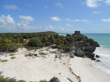
Mazatlán lies at the southern end of the vast state of Sinaloa, a landscape of scrubby desert and jagged mountains spilling into pristine beaches along the Sea of Cortez. The main city in northern Sinaloa is Los Mochis, an uninteresting destination in itself, but as the western terminus of the Copper Canyon railway, an important transport hub. Many train passengers prefer to head inland to El Fuerte, a tranquil colonial backwater some two hours east. In recent years Sinaloa has garnered a reputation as a centre of drug cartel violence, with a subsequent drop-off in tourist numbers, but despite the scary statistics the places of interest remain safe for visitors.
The Copper Canyon
The rugged mountains of the Sierra Tarahumara rise from the Sinaloa coast and crumple into the southwestern part of the state of Chihuahua, encompassing the beautiful region known as the Copper Canyon. Confusingly, the area actually contains six rivers and over eleven major canyons – the actual Barranca del Cobre usually refers to the northern valley of the Río Urique. The main gorges boast depths of more than 2000m, and if you include the whole area the Grand Canyon is tiny in comparison.
Scenically, however, it’s very hard to compare this region with the great canyons of the southwestern US. Part of the difficulty is in getting a true sense of its size and beauty: though the Copper Canyon railway cuts across some spectacular valleys, you only get a glimpse of the actual Barranca del Cobre once, at Divisadero. The train only brushes the northern edge of the Parque Nacional Barranca del Cobre, which is hard to access: there are no well-marked hiking tracks and official campsites, and serious hikers need to devote the best part of a week to their endeavours. Creel makes a sensible base from which to organize further exploration.
Sierra Tarahumara
Once in Creel, most travellers take the bus or continue on the Copper Canyon railway to Chihuahua, but exploration of the Sierra Tarahumara around Creel is highly recommended. The rugged scenery is exceptionally wild and beautiful. If you’re not up to strenuous activity, or have only limited time, an organized tour is the best way to see the canyons (though these normally require four to six people).
San Ignacio de Arareko
Many tours from Creel take in attractions belonging to the ejido (a collectively owned community) of San Ignacio de Arareko, a Rarámuri land-owning cooperative on the edge of town. To see them independently, follow López Mateos towards the highway, take a left onto the dirt road and continue past the cemetery and uphill into the pine forest.
A few kilometres from the ejido entrance, you’ll encounter the eighteenth-century Misión de San Ignacio and a series of otherworldly rock formations, including the Valley of the Mushrooms, which contains surreal structures closely resembling giant toadstools, and the Valley of the Frogs, with its squat amphibian-like boulders. The Valley of the Monks lies 5km away, and has tall upright stones revered by the Rarámuri as symbols of fertility. Serene Lago de Arareco, 7km from Creel on the main highway to Batopilas, is a beautiful spot for fishing (largemouth bass) and camping – you can stay in a cabin on the lake (see Complejo Eco-Turístico Arareko).
Recowata hot springs
The Recowata hot springs are 22km from Creel at the bottom of Tararecua Canyon, within biking or riding distance; follow the road to Divisadero for 7km and look for the turning on the left. Here you can bathe in seven different concrete pools of steamy, clean, sulphurous water. Note that the steep 3km descent to (and return from) the pools can be very strenuous, and shouldn’t be undertaken by the faint of heart (or when it’s wet – it’s a cobblestone trail). Rarámuri quad bikers are sometimes on hand to provide rides up and down.
Cascada de Cusárare
The Cascada de Cusárare, 30m-high and most impressive during the rainy season (but just a trickle in April/May), lies some 22km from Creel on the Batopilas/Guachochi road, and a forty-minute walk from the highway. You can reach the falls and village by bike, or on the daily Batopilas/Guachochi buses, though you’ll have a long hike back to Creel if you don’t stay overnight. Hitching is a possibility, though you should exercise the usual precautions.
Cusárare
The village of Cusárare itself is 3km further along the road from the Cascada de Cusárare, and contains the eighteenth-century Jesuit Misión de Cusárare adorned with Rarámuri wall paintings completed in the 1970s; the mission’s original art, including a set of twelve rare oil paintings by Miguel Correa (scenes from the life of Mary, painted around 1713), were painstakingly restored in the 1990s and are now housed in the Museo de Loyola next door.
Batopilas
If you want to get a true idea of the scale and beauty of the Sierra Tarahumara, consider a trip to isolated BATOPILAS (460m). Located 123km south of Creel, the town is more accessible now the new road has been opened, though the journey still takes at least four hours (at the time of research the final section of the road was still being paved, but traffic was allowed to pass). The route rises and falls through four of the sierra’s six canyons before commencing a final, convoluted descent to the floor of Batopilas canyon. Founded in 1632, the town emerged as a prosperous silver-mining centre, with production peaking in the nineteenth century under the auspices of the American-owned Batopilas Mining Company. After the Mexican Revolution began in 1910, the town went into a permanent decline and the population plummeted. Today Batopilas is a subtropical place with a population of about 1200 – resplendent with bougainvillea, palm and citrus trees and strung along a single 2km road by the Río Batopilas, it’s a world away from the fresh pine forests of Creel. Though it has garnered a reputation for drug cartel activity in recent years, tourists are never affected and the town is being spruced up in preparation for a mini-tourist boom when the road is finally complete (it was made a Pueblo Mágico in 2012).
Hacienda San Miguel
Just outside Batopilas you can visit the romantic ruin of Hacienda San Miguel, once the opulent home of Batopilas Mining Co founder (and ex-Washington D.C. governor) Alexander Shepherd, who washed up here in 1880. Shepherd is a fascinating and somewhat controversial figure in the US, admired for his social reforms and essentially creating modern D.C., but eventually fired for bankrupting the city. The house itself dates back to the seventeenth century and had been used by mining magnates years before Shepherd took over the place. Abandoned in the 1920s (Shepherd had died in 1902), the hacienda has been in a state of elegant decay ever since, one tower virtually engulfed by a sprawling bougainvillea. To reach the site, walk upriver for around thirty minutes, crossing the bridge when you see the ruins.
The hikes
There are several worthwhile hikes here, leading from Rarámuri villages as well as to abandoned mines and waterfalls. The best of these go to the “Lost Cathedral”, the eighteenth-century Misión de San Miguel de Satevó, 8km away in a desolate landscape of cacti and dust. A longer, three-day trek leads to the town of Urique, and can be organized with an operator in Creel.
Guachochi
Rustic GUACHOCHI, about 170km to the south of Creel, is an unattractive ranching town of around twelve thousand that nonetheless provides access to the sierra’s most remote and awe-inspiring locale, the Cañon de la Sinforosa (a further 18km south). Some of the hikes in Sinforosa are fairly hardcore – the canyon is 1830m deep and a trek along its length, for example, can take up to three weeks – while easier walks lead to stunning vantage points overlooking the valleys. There are also various hot springs and waterfalls in the region; the most spectacular is the Cascada Rosalinda with an 80m drop. Rarámuri culture is thriving here, with Norogachi, 60km from Guachochi, one of the last remaining Rarámuri ceremonial centres, especially renowned for the vivid celebrations that occur during Semana Santa.
Cascada de Basaseachi
The jaw-dropping 312m Cascada de Basaseachi (also “Basaséachic”), is the second-highest waterfall in Mexico (though the highest, Piedra Volada, a day’s hike from Basaseachi, only flows during the rainy season). The falls make a long, but spectacularly rewarding day’s excursion – about four hours’ drive to the north of Creel (163km via San Pedro), followed by two hours on foot. It’s best to visit in the rainy season (mid–June to Aug), when the falls are fullest. There are two viewpoints; the first is above the falls beyond the otherwise sleepy village of Basaseachi itself, while the second lies on the other side of canyon, affording the best views (trails connect both viewpoints). The falls are located within the largely unexplored Barranca de Candameña, the widest canyon in the region, with staggering sheer rock walls.
Ferrocarril Chihuahua al Pacífico
The 653km, fifteen-hour train journey along the Ferrocarril Chihuahua al Pacífico (Copper Canyon railway), which starts on the sweaty Pacific coast at Los Mochis, fights its way up to cross the Continental Divide amid the peaks of the Sierra Madre Occidental, then drifts down across the high plains of Chihuahua, is one of the world’s most extraordinary rail journeys. Mesmerizing views come thick and fast as the line hangs over the vast canyons of the Río Urique and its tributaries, with jagged peaks smothered in dense forest, and narrow, precipitous gorges falling away on both sides.
From Los Mochis or El Fuerte, the start of the journey is an inauspicious grind across the humid coastal plain. As the line breaks into the mountains the train zigzags dizzily upwards for six hours, clinging to the canyon wall, rocketing across bridges and plunging into tunnels, only to find itself constantly just a few metres above the track it covered twenty minutes earlier. Eventually, you arrive at Divisadero, where there’s a halt of about fifteen minutes to marvel at the view of the Copper Canyon itself. There are a couple of expensive places to stay here and a few bare-bones cheaper ones as well, but for most people it’s all too rapidly back on the train, which clanks on for an hour to Creel, just past the halfway stage and, at 2330m, close to the highest point of the line (note, though, that after Divisadero the scenery is far less scintillating). This is the place to stop if you seriously want to explore the Sierra Tarahumara and the canyons.
From Creel, the train takes a further six hours to reach Chihuahua – though beautiful, it’s not a truly spectacular run, and at the time of research one of the proposed El Chepe changes was to cut this section entirely. In any case, there’s a regular bus service from Creel to Chihuahua: it’s cheaper than even the second-class train fare, is quicker and covers much the same ground.
El Fuerte
Founded in the sixteenth century, EL FUERTE is a tranquil, verdant town of handsome colonial architecture and lush mango trees. In the 1800s it became rich from mining, and was made a city in 1906; the Revolution devastated the place and it’s been a backwater ever since. In 2009 the town joined Mexico’s burgeoning Pueblos Mágicos programme, and since then the otherwise doomed-to-decay Spanish architecture near the plaza has gradually been restored. Though several boutique hotels have opened up, thanks to low tourist numbers El Fuerte has yet to see a full-scale transformation – the commercial area along Juárez remains just as scrappy as ever, the plaza relatively tourist-free and most of the restored buildings are still empty. Bizarrely, recent attempts to market El Fuerte as the home of Zorro – the fictional character whose adventures were set in California – seem to have worked, with nightly shows at the Posada del Hidalgo.
Located 75km northeast of Los Mochis on the rail line, El Fuerte certainly makes a pleasant alternative start (or end) to the Copper Canyon train ride, and is a far more appealing place to stay than Los Mochis. Just make sure you take insect repellent – Fuerte’s bobos (tiny two-winged insects more officially known as Paraleucopis mexicana) are a real pest in the spring.
The town centre is small and easy to navigate, being focused on the elegant portales of Plaza de Armas, with its grand Palacio Municipal (1907), the modest Iglesia Sagrado de Corazón (1745) and the fort (fuerte) itself, a short walk south (and clearly visible).
The Rarámuri
Even when the bare mountain peaks here are snow-covered, the climate on the Copper Canyon floor is semitropical – a fact that the indigenous Rarámuri (also known, incorrectly, as the Tarahumara), depend on, migrating in winter to the warmth of the deep canyons. The Rarámuri, who were driven here after the Spanish Conquest and whose population now totals some sixty thousand, live in isolated communities along the rail line and in the surrounding Sierra Tarahumara, eking out an existence from the sparse patches of cultivatable land. Although their isolation is increasingly encroached upon by commercial forestry interests, ranchers and growing numbers of travellers, they remain an independent people, close to their traditions. Despite centuries of missionary work, their religious life embraces only token aspects of Catholicism and otherwise remains true to its animist roots, their chief deities being the gods of the sun, moon and rain. Above all, the tribe is renowned for running: a common feature of local festivals are the foot races between villages that last at least one day and sometimes several on end, with the runners kicking a wooden ball ahead of them as they go (Norogachi is one of the best places to see this, as is Urique, the home of the Copper Canyon Ultramarathon).
Creel
Once nothing more than a rough-and-ready backwater, CREEL (2330m) has rapidly transformed into a full-blown mountain resort of ten thousand people. Indeed, Creel is yet another Pueblo Mágico and has seen tourism all but replace logging as its main industry; on most days (but especially Sunday) you’ll be greeted by a weird juxtaposition of laidback Western backpackers, smartly dressed locals, rich Mexican tourists in their 4WDs and ragged Rarámuri trinket sellers and their children, trying to make a buck or two. In July and August the town is invaded by Mexican tour groups – the best hotels often get completely booked up at this time. This is not to say that the town has become completely commercial; beneath the facade of development, Creel is still a rural mountain town at heart, and an ideal base from which to explore the area. Note that construction of Creel’s airport – Aeropuerto Regional Barrancas del Cobre – was delayed in 2014 after protests by the local Rarámuri, but should be operating sometime in 2016.
The Mennonites
Towards the eastern end of the Copper Canyon rail line, the city of Cuauhtémoc contains Mexico’s largest Mennonite community (around fifty thousand). You’ll come across Mennonites throughout Chihuahua and Durango – the men in bib-and-tucker overalls and straw stetsons, as often as not trying to sell the tasty cheese that is their main produce, and the women, mostly silent, wrapped in long, nineteenth-century dresses with a headscarf. The Christian sect, founded in the sixteenth century by a Dutchman, Menno Simons, believe only in the Bible and their personal conscience: their refusal to do military service or take national oaths of loyalty has led to a long history of persecution; today there are famously large communities of Mennonites (and their Amish cousins) in Pennsylvania, US. The Mennonites arrived in Mexico in the 1920s from Manitoba, Canada, but among themselves they still speak a form of German, although so divergent as to be virtually unintelligible to a modern German-speaker. Note that the Mennonites of Cuauhtémoc are not as traditional as their American cousins these days – indeed, they own local banks, stores and restaurants.
The runners of Copper Canyon
Popularized by Chris McDougall’s best-selling book Born to Run (2009), the Copper Canyon Ultramarathon or "Ultramaraton Caballo Blanco" was established in 2003 by extreme runner Micah True (his nickname was Caballo Blanco, or “White Horse”). True (who died in 2012) wanted to draw attention to the plight of the impoverished Rarámuri in the region, and the 80km race, though now open to anyone, still provides food vouchers and blankets to Rarámuri runners. In large part thanks to the book, the race has become a legend in the world of ultra-running, attracting around a hundred international runners each year. Usually held in February in Urique, in 2015 the race was cancelled due to concerns about drug-related gang violence in the valley – check norawas.org for the latest.
Álamos
Another Pueblo Mágico, the enchanting town of ÁLAMOS offers a tranquil slice of colonial Mexico and a welcome break from the dusty cities along the main north-south highways. It’s a great place to do nothing for a while: a tour of the town takes no longer than a couple of hours, and there’s little else to do but soak up the languid atmosphere.
In the cooler winter months, Álamos is also a good base for exploring the fairly distinct ecosystem hereabouts; the meeting of Sonoran and Sinaloan deserts, at the foot of the Sierra Madre Occidental, has created a home for a broad range of flora and fauna. In particular, this is a birdwatching paradise, boasting several hundred different species.
San Carlos
Around 16km west of Guaymas, the small town of SAN CARLOS is gradually becoming a larger resort geared towards a mainly retired North American clientele. The main activities here are diving and fishing, though the chief attraction above the water is the scenery: the resort is dominated by the barren, jagged peaks of Cerro Tatakawi, and the scorched desert landscape makes a stunning backdrop to a series of inviting bays, beaches and cobalt-blue waters. Founded only in the 1960s, San Carlos sports a seasonal population of around seven thousand today.