1770 and around
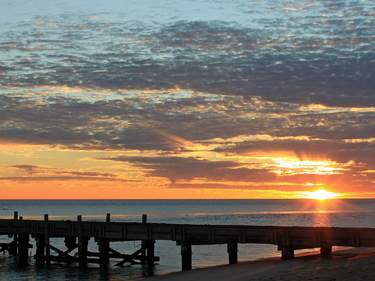
Smaller than Agnes Water, 1770 (also called Seventeen Seventy, or Town of 1770) occupies the foreshore of a narrow promontory some 6km to the north and is the launch pad for boats out to Lady Musgrave Island and nearby reefs. At the end of the road is windswept Round Hill, with exposed walking trails and coastal views. There are few places to stay here bar holiday rentals, although most visitors come here for day-trips to the Reef, local tours, watersports and spectacular sunsets.
Eurimbula National Park, on the west side of 1770 across Round Hill Creek, abounds with birdlife. You can tour the region aboard The LARC amphibious bus, which explores this remote stretch of coastline and runs fun day-tours to the pristine Bustard Lighthouse. For 4WD road access to the park, head 10.5km back towards Miriam Vale from Agnes Water, where you’ll see the National Park sign to the north of the road.
Agnes Water
On the coast 100km north of Bundaberg along the Rosedale road, the tiny settlements of Agnes Water and nearby 1770 mark the spot where Captain Cook first set foot in Queensland on May 24, 1770. It’s a pretty area whose attractions include pockets of mangrove, fan palm and paperbark wetlands, and Queensland’s northernmost surf beach.
Agnes Water consists of a service station, two shopping complexes, several large resort villages, a couple of cafés and the Agnes Water Tavern – which does excellent meals. The town is fronted by a stunning, sweeping beach backed by sand dunes, and there are some delightful coastal walks in the area, including the 3km trail from Agnes Headland along the wooded ridge to Springs Beach, which is best reached from the Museum next to the Visitor Centre on Springs Road.
Bundaberg
Fifty kilometres off the highway from Childers, surrounded by cane fields and fruit farms, BUNDABERG is famous for its rum, though the town is otherwise a humdrum place whose attractions are scarcely advertised. Those looking for farm work are virtually guaranteed seasonal employment (mostly Feb–Nov) picking avocados, tomatoes, snow peas and courgettes on farms in the area. Bundaberg lies on the Burnett River, about 15km from the coast where marine turtles mass in huge numbers every summer to lay their eggs on the beaches of Mon Repos. You can also fly from Bundaberg to the local Barrier Reef cay, Lady Elliot Island, which offers a basic eco-resort and good scuba diving.
The Great Barrier Reef
The Great Barrier Reef is to Australia what rolling savannahs and game parks are to Africa, and is equally subject to the corniest of representations. “Another world” is the commonest cliché, which doesn’t begin to describe the feeling of donning mask and fins and coming face to face with extraordinary animals, shapes and colours. There’s so little relationship to life above the surface that distinctions normally taken for granted – such as that between animal, plant and plain rock – seem blurred, while the respective roles of observer and observed are constantly challenged by shoals of curious fish following you about.
Beginning with Lady Elliot Island, out from Bundaberg, and extending 2300km north to New Guinea, the Barrier Reef follows the outer edge of Australia’s continental plate, running closer to land as it moves north: while it’s 300km to the main body from Gladstone, Cairns is barely 50km distant from the Reef. Far from being a continuous, unified structure, the nature of the Reef varies along its length: the majority is made up by an intricate maze of individual, disconnected patch reefs, which – especially in the southern sections – sometimes act as anchors for the formation of low sand islands known as cays; continental islands everywhere become ringed by fringing reefs; and northern sections form long ribbons. All of it, however, was built by one kind of animal: the tiny coral polyp. Simple organisms, related to sea anemones, polyps grow together like building blocks to create modular colonies – corals – that form the framework of the Reef’s ecology by providing food, shelter and hunting grounds for larger, more mobile species. Around their walls and canyons flows a bewildering assortment of creatures: large rays and turtles “fly” effortlessly by, fish dodge between caves and coral branches, snails sift the sand for edibles, and brightly coloured nudibranchs dance above rocks.
The reef is administered by the Marine Parks Authority, which battles against – or at least attempts to gauge – the effects of overfishing, pollution, agricultural run-off, environmental fluctuations and tourism. All these things are beginning to have a serious effect on the Reef, with many formerly colourful coral gardens reduced to weed-strewn rubble. Don’t let this put you off going – the Reef is still unquestionably worth seeing, and if the government realizes how much tourism will be lost if the Reef dies, they may get more involved in protecting it. In order to minimize damage, visitors should never stand on or hold onto reefs when snorkelling or diving; even if you don’t break off branches, you’ll certainly crush the delicate polyps.
Diving and other ways of seeing the Reef
Scuba diving is the best way to get to grips with the Reef, and dive courses are on offer right along the coast. Five days is the minimum needed to safely cover the course work – three days pool and theory, two days at sea – and secure you the all-important C-card. The quality of training and the price you pay vary; before signing up, ask others who have taken courses about specific businesses’ general attitude and whether they just seem concerned about processing as many students in as short a time as possible. Another consideration is whether you ever plan to dive again: if this seems unlikely, resort dives (a single dive with an instructor) will set you back only $70 or so, and they’re usually available on day-trips to the Reef and island resorts. Qualified divers can save on rental costs by bringing some gear along; tanks and weightbelts are covered in dive packages, but anything else is extra. You need an alternative air source, timer, C-card and log book to dive in Queensland (the last is often ignored, but some places insist, especially for deep or night-time dives).
Snorkelling is a good alternative to diving: you can pick up the basics in five minutes, and with a little practice the only thing you sacrifice is the extended dive time that a tank allows. If you think you’ll do a fair amount, buy your own mask and snorkel – they’re not dramatically expensive – as rental gear nearly always leaks. Look for a silicone rubber and toughened glass mask and ask the shop staff to show you how to find a good fit. If getting wet just isn’t for you, try glass-bottomed boats or “subs”, or even a “helmet dive” which can still turn up everything from sharks to oysters.
Reef Tax
The Marine Park Authority levies an Environmental Management Charge (EMC), sometimes referred to as reef tax (currently $20 per day, though some tour operators add $3–5 extra for administration) to help fund monitoring and management of human impact on the Reef. EMC is not usually included in the upfront price of tours and boat trips (unless perhaps a liveaboard); usually you’re asked to pay during the trip.