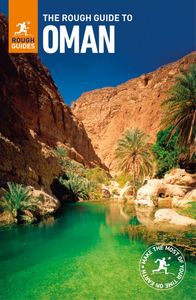
Khor ash Sham
The longest and most dramatic of all the Musandam khors, Khor ash Sham stretches for some 16km in total, hemmed in between two high lines of mountains, the bareness of the craggy surrounding rocks offering a surreal contrast with the invitingly blue waters of the khor itself. A string of remote hamlets dots the shoreline, accessible only by boat; each is home to just ten or so families. All water has to be shipped in by boat, while children must commute to school in Khasab. Not surprisingly, the khor-side settlements are becoming steadily depopulated as the younger generation of villagers tires of the rather monotonous life of their ancestors and move off to Khasab or beyond. Those who remain live in the villages for just six months a year, earning a living through fishing, before decamping to harvest dates in Khasab during the summer months, when the water in the khor becomes too hot for fish.
The khors also boast a healthy population of dolphins, and you’ve got probably an eighty percent chance of seeing at least one pod during a full-day dhow cruise. Dolphins are attracted by the sound of boats’ engines and the water churned up in their wake – they’ll often swim alongside passing dhows, dipping playfully in and out of the water, reaching remarkable speeds and keeping up quite easily with even the fastest dhows.
About halfway down Khor ash Sham lies lonely Telegraph Island (or Jazirat Telegraph), an extremely modest bit of rock named after the British telegraph station which formerly stood here. The extensive foundations of the old British buildings survive, along with a flight of stone steps leading up from the water. The island is a popular stopping point on dhow cruises which often halt here for lunch. Boats can moor next to the island at high tide; at low tide you’ll have to swim across.
Going round the bend in Musandam
Despite its rather unprepossessing appearance today, Telegraph Island was once a crucial hub in the nineteenth-century information superhighway, and a vital link in the chain of communication between Britain and her Indian empire. At a time when mail between London and Bombay took at least a month to arrive, messages could be sent between the two cities in as little as two hours via submarine telegraph cables – or the “Victorian internet”, as it has been neatly described.
In 1864, the governments of India, Turkey and Persia agreed to join up their existing land telegraphs using a submarine cable through the Gulf and on to Karachi. Almost 2400km of cable was manufactured and laid out, passing through Musandam en route. In 1865, a small telegraph repeater station was constructed on the island formerly known as Jazirat al Maqlab, but ever since as Telegraph Island, a site chosen since it offered greater security than the mainland against potentially hostile local tribes. The station played a crucial role in the success of the cable. Telegraphic signals relayed over copper cable inevitably fade with distance, and the function of the station was to receive and relay, or “repeat”, signals received from either London or Bombay.
Unfortunately, the location was one of the remotest in the empire. The mental and physical privations suffered by officials marooned on Telegraph Island quickly became the stuff of colonial legend, so much so that relief crews sailing eastwards around the tip of the Musandam peninsula coined the expression “going round the bend” to describe their mercy missions – an expression which has since become Oman’s lasting contribution to the English vernacular and a fitting tribute to the sufferings of Telegraph Island’s Victorian castaways.
The station lasted just three years and in 1868 the cable was diverted away from Musandam and rerouted via the Iranian island of Hengham.
Kumzar
One of the most inaccessible settlements in Oman, the famously remote town of KUMZAR sits perched in solitary splendour at the northernmost edge of Musandam, hemmed in by sheer mountains and accessible only by boat. Sadly, outsiders (meaning non-resident Omanis as well as foreign tourists) have been banned from landing in the town since 2010 as a result of locals complaining about the intrusive behaviour of tourists. A “visit” to the town therefore involves sitting in your boat in the harbour about 100m offshore and seeing what you can, although it’s still well worth making the trip out here for the magnificent coastal scenery en route, as well as for the tantalizing glimpse of Oman’s most reclusive town at the end of it. Many of Musandam’s best diving spots are also located in the waters around Kumzar for more details. For details about boat trips to Kumzar.
Geographically, Kumzar is a paradox. By land, this is one of the most remote and inaccessible settlements in Oman. By sea, however, the town overlooks the Straits of Hormuz, one of the world’s busiest shipping lanes, a fact reflected in the unique language spoken by its inhabitants, Kumzari. The village is said to be around seven hundred years old, its inhabitants including a hotchpotch of ethnic groups ranging from Yemeni to Zanzibari – the colourful theory that sailors shipwrecked off the nearby coast were also integrated into the population is backed up by the remarkable number of European and Hindi loan words found in Kumzari. The town’s population currently stands at around five thousand, with its own school, hospital, power station and desalination plant. The inhabitants live largely by fishing for nine months of the year, netting barracuda, tuna, kingfish and hammour (much of which ends up in the restaurants of Dubai), before retreating to Khasab for the hot summer months.
The trip out to Kumzar by speedboat takes around 45min–1hr from Khasab, or around 2hr 30min by dhow. The ride takes you out past the magnificent sea cliffs enclosing the entrance to Khasab harbour, past the entrance to the fine Khor Ghob Ali, and then Goat Island (Jazirat al Ghanim), ringed with fluted limestone cliffs. In the past, local Kumzaris would often bring their sheep and goats across to the island by boat to graze, given the lack of suitable pastureland around Kumzar itself – hence the name. Throughout the trip, there is remarkably little sign of human habitation, saving a few military buildings on Goat Island.
Beyond Goat Island you enter the Straits of Hormuz, with magnificent seascapes, craggy headlands and a considerable number of oil tankers; the three rocky islands way out to sea are collectively known as the Jazirat Salamah, the most northerly piece of Omani territory. Ten minutes or so later you round a final headland, getting your first sight of Kumzar, with its colourful huddle of buildings backed up against the sheer wall of the mountains behind. Although you can’t actually land, you can approach close enough to get a reasonably good view of the town. Space is very much at a premium here; it’s said that the village cemetery was filled hundreds of years ago, and that locals are now obliged to bury their relatives in the grounds of their own houses.
Kumzari
Kumzar is famous for the fact that it preserves its own language, Kumzari – a remarkable linguistic monument to the region’s surprisingly cosmopolitan past. Kumzari is still very much a living language, despite the fact that it is spoken only in Kumzar town itself and on Larek Island in Iran, just across the Straits of Hormuz. Local children speak Kumzari as their first language, and don’t necessarily learn Arabic until they get to school. Until quite recently older generations remained determinedly monoglot, speaking nothing but Kumzari – and according to local reports there’s at least one old man in the village who remains resolutely unfamiliar with any other tongue.
The basis of Kumzari is Farsi (the language of Iran, which Kumzari most obviously resembles), mixed up with a significant dose of Arabic and Hindi (the result of long-standing trade with India), plus a significant number of loan words from assorted European languages including English, Portuguese, French, Italian and Spanish – a remarkable linguistic melting pot. The numbers for one to five – yek, do, so, char, panch – for example, are almost identical to their Hindi equivalents, while the Kumzari word for bread, naan, will also be strangely familiar to anyone who has ever eaten in an Indian restaurant. Many European loan words have also entered the language, including (to name just a few) upset, door, light, starg (stars), cherie (child), toilette (meaning, in Kumzari, a haircut) and bandera (from Spanish, meaning “flag”). Things have occasionally got slightly lost in translation, however: the word kayak, for instance, means a speedboat rather than a canoe, while the words open doro can serve as an instruction not only to open the door, but to close it too.
_listing_1481212452382.jpeg)