Western Australia

Western Australia covers a third of the Australian continent, yet it has a population of just 2.3 million. Conscious of its isolation from the more populous eastern states – or indeed anywhere else – WA has a strong sense of its own identity and a population who are very proud to call this state their home. And well they should be. The state offers an enticing mix of Outback grandeur and laidback living, and is attracting increasing numbers of tourists keen to break away from “the East”, as the rest of Australia is known in these parts.

Where to go in Western Australia

Perth, the state’s capital and where most of its population is based, retains the leisure-oriented vitality of a young city, while the atmospheric port of Fremantle, really just a suburb of the city, resonates with a youthful and somewhat boisterous charm. South of Perth, the wooded hills and trickling streams of the Southwest support the state’s most celebrated wine-growing region Margaret River, while the giant eucalyptus forests around Pemberton provide numerous opportunities for hiking and generally getting to grips with nature.

East of the forests is the state’s intensively farmed wheat belt, an interminable man-made prairie struggling against the saline soils it has created. Along the Southern Ocean’s stunning storm-washed coastline, Albany is the primary settlement; the dramatic granite peaks of the Stirling Ranges just visible from its hilltops are among the most botanically diverse habitats on the planet. Further east, past the beautifully sited coastal town of Esperance on the edge of the Great Australian Bight, is the Nullarbor Plain, while inland are the Eastern Goldfields around Kalgoorlie, the largest inland town in this region and a hardy survivor of the century-old mineral boom on which WA’s prosperity is still firmly based.

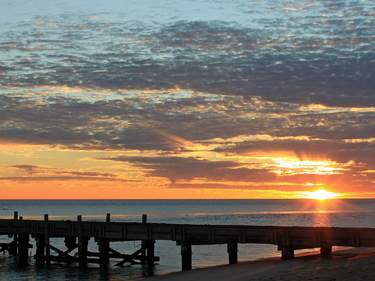
While the temperate southwest of WA has been tamed by an increasing urbanization, the north of the state is where you’ll discover the raw appeal of the Outback. The virtually unpopulated inland deserts are blanketed with spinifex and support remote Aboriginal and mining communities, while the west coast’s winds abate once you venture into the tropics north of Shark Bay, home of the friendly dolphins at Monkey Mia. From here, the mineral-rich Pilbara region fills the state’s northwest shoulder, with the dramatic gorges of the Karijini National Park at its core. An unmissable attraction on the state’s central coast – aka the Coral Coast – is the unspoiled and easily accessible Ningaloo Reef, the world’s largest fringing reef; those in the know rate it more highly than Queensland’s attention-grabbing Great Barrier Reef.

Northeast of the Pilbara, the Kimberley is regarded as Australia’s last frontier. Broome, once the world’s pearling capital, is a beacon of civilization in this hard-won cattle country, while adventurous travellers fall in love with the stirring, dusty scenery around Cape Leveque and the Gibb River Road. The region’s convoluted, barely accessible coasts are washed by huge tides and occupied only by secluded pearling operations, a handful of Aboriginal communities, a couple of luxury retreats, and crocodiles. On the way to the Northern Territory border is Purnululu National Park, home to the surreal Bungle Bungle massif – one of Australia’s greatest natural wonders.

Climate of Western Australia

WA’s climate is a seasonal mix of temperate, arid and tropical. Winters are cool in the south and wet in the southwest corner, while at this time of year the far north basks in daily temperatures of around 30°C, with no rain and tolerable humidity: this is the tropical dry season. Come the summer, the wet season or “Wet” (Dec–April) renders the Kimberley lush but inaccessible, while the rest of the state, particularly inland areas, crackles in the heat, with temperatures frequently climbing above 40°C. The southern coast is the only retreat for the heat-struck; the southwest coast is cooled by dependable afternoon sea breezes, known in Perth as the “Fremantle Doctor”.

Brief history of Western Australia

Aborigines had lived in WA for at least forty thousand years by the time the seventeenth-century traders of the Dutch East India Company began wrecking themselves on the west coast mid-journey to the Dutch East Indies (modern-day Indonesia), where they sought valuable spices. While some dispute remains about the first foreigner to see Australia, with French, Portuguese and Chinese explorers all laying a claim, it can safely be said that Dutch mariner Dirk Hartog was the first European to set foot on Western Australian soil, leaving an inscribed pewter plate on the island off Shark Bay that now bears his name, in 1616. For the next two hundred years, however, WA’s barren lands remained – commercially at least – uninspiring to European colonists.

France’s interest in Australia’s southwest corner at the beginning of the nineteenth century led the British to hastily claim the unknown western part of the continent in 1826, establishing Fredrickstown (Albany) on the south coast; the Swan River Colony, today’s Perth, followed three years later. The new colony initially rejected convict labour and as a result struggled desperately in its early years, but it had the familiar effect on an Aboriginal population that was at best misunderstood and at worst annihilated.

Economic problems continued for the settlers until stalwart explorers in the mid-nineteenth century opened up the country’s interior, leading to the gold rushes of the 1890s that propelled the colony into autonomous statehood by the time of Australian federation in 1901. This autonomy, and growing antipathy towards the eastern states, led to a move to secede in the depressed 1930s, when WA felt the rest of the country was dragging it down – an attitude that persists today. However, following World War II the whole of white Australia – and especially WA – began to thrive, making money first from wool and later from huge iron ore and offshore gas discoveries that continue to form the basis of the state’s wealth. Meanwhile, most of WA’s seventy thousand Aborigines continue to live in desperately poor and remote communities, as if in another country.

Around Perth

For excursions beyond central Perth, the port of Fremantle, at the mouth of the Swan River, should not be overlooked, nor should a trip over to Rottnest Island, a ninety-minute ferry ride from the city. It is also well worth the short trip out to Hillary’s Boat Harbour to visit the aquarium. Perth’s beaches form a near-unbroken line north of Fremantle, just a short train or bus ride from the centre, with Cottesloe and Scarborough the top picks. With your own vehicle you can escape to the Upper Swan Valley wineries and the national parks inland, which run parallel to the coast and atop the Darling Ranges, where patchily forested hills, just half an hour’s drive east of the city, offer a network of scenic drives and marked walking trails among the jarrah woodlands. Further afield, the monastic community of New Norcia can make a satisfying day-trip.

Fremantle

Although long since merged into the metropolitan area’s suburban sprawl, Perth’s port of FREMANTLE – “Freo” – retains a character altogether different to the centre of Perth. It’s small enough to keep its energy focused, with a real working harbour and busy yacht marina, and has an eclectic, arty ambience without too many upmarket pretensions. The town attracts people for its famed weekend markets (worth planning your visit around) and café-lined “Cappuccino Strip” or South Terrace where funky boutiques are also found. It’s worth noting that in the heat of summer Fremantle is often a breezy 5°C cooler than Perth, a mere half an hour away by train.

Exploring Fremantle on foot, with plenty of streetside café breaks, is the most agreeable way of visiting the town’s compactly grouped sights. If you want to tick off all of them, start your appraisal on the east side before moving down to the ocean to end up at the Fishing Boat Harbour, ready for a sunset seafood dinner.

The Swan Valley

Dating back to the earliest years of the colony, Guildford, a twenty-minute drive up the Swan River from Perth, is a historic town with several Federation-era grand hotels, a number of historic buildings, antique shops and cafés. The town serves as a gateway for the SWAN VALLEY – WA’s oldest wine-growing region.

The Swan Valley makes for a pleasant day’s wine tasting and, being within such easy reach of Perth CBD, is an attractive rival to the more famous Margaret River region several hours’ drive to the south. Two main roads run through the valley from Guildford – West Swan Road and the Great Northern Highway. These run either side of the Swan River and pretty much mark the extent of the fertile land – everything between river and road is ripe for grape-growing and this strip is where you will find all the major wineries.

Swan Valley wineries

Black Swan

8600 West Swan Rd, Henley Brook 08 9296 6090, blackswanwines.com.au. One of the newer wineries on the Swan, this beautiful vineyard produced its first vintage in 2001. The Cabernet Sauvignon and Cabernet Franc are particularly well regarded and the food served in the on-site restaurant is well worth stopping by for. Lamb shank is $38. Restaurant open for lunch daily from 11.30am and for dinner Wed–Sat from 5.30pm. Tasting $3, or free with lunch. Tastings daily 11am–3pm.

Houghton’s

Dale Rd, Middle Swan 08 9274 9540, houghton-wines.com.au. This was one of the first vineyards on the Swan and it shows in the quality of the wines. Chenin Blanc, Chardonnay and Verdelho are grown here, with Cabernet Sauvignon and Malbec brought up from Margaret River to make some cracking reds too. There’s a small museum, art gallery and café on-site. Tastings $3. Daily 10am–5pm.

Sandalford

3210 West Swan Rd, Caversham 08 9374 9374, sandalford.com. Along with Houghton’s, this is the valley’s biggest name, with a range of wines that run the gamut from classy whites to rich reds. You can also do a winery tour for $22 (11am and 3pm daily). Tastings from $2.50. Mon–Fri 9.30am–5pm, Sat & Sun 9.30am–6pm.

Sittella’s

Barratt St, Herne Hill 08 9296 2600, sittella.com.au. Don’t know much about wine? Make Sittella’s your first port of call for a tasting with Shannon – one of the most knowledgeable cellar-door managers you are likely to ever meet. Enjoy a free tasting (don’t miss the sparkling wines) and stay for lunch in the classy restaurant, where the full range of wines are served to wash down the steak and seafood. Free tastings. Tues–Sun 11am–4pm.

The Batavia Coast

The Batavia Coast’s moniker comes from the Dutch East India Company’s ship the Batavia, which was wrecked off the Houtman Abrolhos islands, 80km west of Geraldton, in 1629 – just one of many ships wrecked in this area. Travelling north up this coastline from Perth, the first obligatory stop is Nambung National Park where the weird and wonderful Pinnacles are one of WA’s must-sees. Avoid the dreary Brand Highway in favour of the more scenic Indian Ocean Drive to reach the Pinnacles in around two and a half hours, making a (long) day-trip from Perth a possibility. Alternatively, stop over in the windswept crayfishing town of Cervantes.

Geraldton is the Batavia Coast’s administrative centre and a decent place to stock up for the onward journey, while further north the attractive seaside resort of Kalbarri is an enticing place to spend a day or two. Historic Greenough also makes a worthwhile stopover.

Ships and shipwrecks

This stretch of coast is awash with maritime history. The seventeenth and eighteenth centuries were notable for the wrecking of numerous Dutch East India Company ships, including the Batavia in 1629, and the Zuytdorp in 1710. The Batavia’s story is especially compelling: the ship set sail from Amsterdam in 1628 for the Dutch East Indies, laden with silver and other goodies to trade for precious spices on arrival. During the journey, merchants Adriaene Jacobsz and Jeronimus Cornelisz hatched a plan to hijack the ship and effect a mutiny, allowing them to steal the booty on board and start a new life somewhere. After Jacobsz deliberately steered the ship off course, the Batavia struck a reef close to the Houtman Abrolhos islands. Most passengers managed to get ashore, but on finding no fresh water Captain François Pelsaert, Jacobsz and other crew members set off to find help, eventually arriving at Batavia (modern-day Jakarta) 33 days later. Pelsaert was given a new ship with which to rescue those left on the island, but on his return found that Cornelisz had unleashed a bloody mutiny, killing 125 survivors. The wreck of the Batavia was salvaged in the 1970s, with many of the items on board now displayed in museums in Geraldton and Fremantle.

In the 1920s the remains of a castaway’s camp were discovered on the clifftops between Kalbarri and Shark Bay, subsequently named the Zuytdorp Cliffs. The fate of the Zuytdorp survivors had been a 300-year-old mystery until a rare disease endemic among seventeenth-century Afrikaaners (ships en route to the Dutch East Indies routinely stopped in South Africa to stock up on provisions) was discovered in local Aborigines, which suggests that some of the castaways survived long enough to pass the gene on. Recent research has discredited this idea, but controversy surrounding the wreck remains, with various locals claiming its discovery between the 1920s and 1960s, and accusations of looting rife.

In modern times, the ship that has most interested WA is the HMAS Sydney, whose success in the early years of World War II was the source of much national pride. It was sunk in mysterious circumstances off the West Australian coast in 1941, after a confrontation with the Kormoran, a German merchant trader disguised as a Dutch ship. After decades of searching (and a bill of some $3.5 million), the ship was found 200km off Steep Point near Shark Bay on 16 March, 2008, 22km away from the Kormoran. It made front-page news in Australia and finally granted some peace to the families of the 645-strong crew who were lost.

The Central Midlands – inland to the Pilbara

About 1000km north of Perth are the ancient, mineral-rich highlands of the Pilbara, an area that includes Mount Meharry, at 1249m the highest point in WA. The world’s richest surface deposits of iron ore were developed here in the 1950s and rich discoveries of ore, crude oil, natural gas and salt continue to be made as private railroads cart the booty to the coast for export to the hungry markets in Japan and China. As a result, company towns such as Tom Price and Newman abound, offering little to travellers except mine tours and overpriced accommodation. While the Pilbara is unquestionably the economic powerhouse of the state (and indeed the nation), the unquenchable growth of the mining industries has had knock-on effects throughout the region. Chronic housing shortages plague many towns, Karratha and Port Hedland in particular, and hotels and hostels are increasingly bought up by companies desperate to house their staff. Surrounding the huge open-cast mine sites are vast, arid pastoral stations, recovering from or surrendering to overgrazing. In the middle of all this environmental chaos Karijini National Park serenely remains, safeguarding some of Australia’s most spectacular and timeless natural scenery. Up the coast, Cossack and Port Samson offer respite from the relentless heat and mining mentality.

Karijini National Park

Karijini National Park is WA’s second-largest protected area, with spectacular, accessible gorges in the north and a vast unvisited section to the south, separated roughly by Karijini Drive, the southernmost of the two roads running through the park. Travellers rave about the nerve-jangling walks, timeless scenery and sparkling waterholes here, and are often taken aback at the lush, spinifex-covered hills and proliferation of white-trunked snappy gums that sprout from the blood-red rock, distinguishing the Pilbara from the better-known but drier Kimberley, especially in July and August (the busiest months).

The gorges themselves cut through the north-facing escarpment of the Hamersley Ranges and all offer spectacular views as well as a range of graded walks through their interiors. There are scores of superlative swimming holes in the park too, but they tend to be situated deep in the gorges, and are rarely less than absolutely freezing, even on the hottest days.

Karijini Drive is sealed, but the northern Banjima Drive, which runs between the gorges, is predominantly corrugated dirt. Barring adverse weather, the park remains accessible for all vehicles throughout the year, although 2WD may find things a little bumpy. The gorges get extremely hot between November and April, making the winter the best time to visit, and flash floods are reasonably common so keep an eye on the weather forecast. Keep a check on your watch too – ascending out of the gorges in anything less than full daylight is a definite no-no.

The park has a western entrance, accessed from Highway 1 via Tom Price, and an eastern entrance, accessed via the Great Northern Highway from Newman in the south or Port Hedland to the north. Whichever way you enter, make sure you fill up at the last available fuel station as driving distances in the park tend to be underestimated; count on doing around 250km. There’s limited food and drinking water in the park, so it’s best to bring your own just in case.

Graded walks

Across Australia, all walking routes are marked as being in one of six different classes. Classes 1–3 can be completed comfortably by most, Class 4 requires a reasonable level of fitness, while Class 5 tend to be exhilarating semi-Indiana Jones-style adventures. Class 6 requires you to either be a qualified rock-climber and abseiler with all the necessary equipment, or on a guided tour.

While lesser trails are not uniformly well marked, the “Trail Risk” signs certainly are, and will warn you if you’re about to venture into a Class 6 area. Injuries are common in Karijini National Park, and fatalities do occur, so think carefully about which trail your level of fitness will allow you to complete comfortably, and wear solid walking sandals – on many walks a small slip could see you plunge a fair distance down a gorge face.

The Coral Coast

The beautiful Coral Coast stretches from Shark Bay, an ecological and evolutionary hotspot of the highest order, up to the arid spike of land on which Exmouth and Coral Bay rest. People head here to see the stunning 260km Ningaloo Reef that fringes the western edge of the peninsula, never more than 7km offshore and in places accessible right from the beach. Increasing numbers head to the tiny, laidback resort of Coral Bay at the southern end of the reef, rather than basing themselves in sterile Exmouth, near the tip of the peninsula.

Aside from viewing the reef, people flock here for the rare opportunity to swim with the world’s largest fish, the whale shark, which feeds in the area between April and July each year. In between Shark Bay and Exmouth is Carnarvon, a good base for exploring the exhilarating 4WD track north to Gnaraloo Station, past wild beaches and tumultuous seas.

Ningaloo Marine Park

Ningaloo Marine Park protects Ningaloo Reef, the world’s largest fringing reef and Australia’s most accessible – simply step off the white sands of the beach and float over the coral gardens. Ningaloo Reef runs for 300 kilometres from Bundegi Reef in the Exmouth gulf, along the shores of Cape Range National Park and all the way down to Red Bluff, just north of Carnarvon. It extends for some 10 nautical miles out to sea and covers more than 5000 square kilometres of ocean. It is the proximity of the continental shelf that gives this marine park such a stunning variety of marine life: more than 700 species of fish and 250 species of coral have been recorded here, attracting migrating humpback whales and whale sharks, plus numerous turtles, reef sharks and rays. There are few better places in Australia – if not the world – for snorkelling to see marine life.

Shark Bay

Shark Bay is the name given to the two prongs of land and their corresponding lagoons situated west of Overlander Roadhouse on Highway 1. Denham, the only settlement, is on the western side of the eastern Peron Peninsula, while at Monkey Mia on the sheltered eastern side, bottlenose dolphins have been coming in to the beach almost daily since the 1960s. Shark Bay was World Heritage listed in 1991; this remarkable place qualifies for listing under no less than four of UNESCO’s “natural” criteria. Note that fresh water is very precious in the Shark Bay area: salty bore water is used as much as possible.

Monkey Mia

After all the hype, you might be surprised to find that Monkey Mia is just a resort and a jetty by a pretty beach. It’s to this beach that scores of people flock to see the almost daily visits by between five and ten adult female dolphins and their attendant calves, all known by name. Get here at 7.30am to watch the first feeding at around 8am. There are usually another two feeds per day, always before noon, to encourage the dolphins to spend the afternoon foraging for food in the bay – these two later feeds can be a better option if you don’t want to fight your way through the excitable crowds standing in the shallows.

Swimming with whale sharks

There are few experiences in life more memorable than swimming with a whale shark, the world’s largest fish, and Ningaloo is one of only a few places worldwide where they appear with any regularity – and in easily accessible waters.

It is the mass spawning of more than 200 species of coral every March or April that brings the whale sharks here and sightings are common until July. Interaction with these gentle giants (the juvenile males seen here can measure up to 12 metres long) is strictly regulated, with only one boat allowed to operate within the exclusive contact zone of 250 metres around each whale shark at any one time and just 10 swimmers in the water at once. This keeps both the whale shark itself and your interaction with it calm and relaxed – you won’t be surrounded by too many other people. You will need to be a competent swimmer and can expect to be in and out of the water all day.

Nothing can prepare you for the utter delight of swimming alongside a fish the size of a bus and with your eyes and ears in the water all else is blocked out until you emerge from this other-worldly experience. If you are in Exmouth during whale shark season this is absolutely not to be missed.

There are numerous whale shark tour operators running trips out from Exmouth and a few based in Coral Bay too. Some have their own spotter planes to increase the likelihood of finding a whale shark and all will equip you with masks, snorkel and fins, plus a wetsuit.

Coral Bay Ecotours coralbayecotours.com.au.

Ningaloo Experience ningalooexperience.com.

Ningaloo Reef Dreaming ningaloodreaming.com.

Ocean Eco Adventures oceanecoadventures.com.au. Thanks to their exclusive spotter plane, whale shark sightings on Ocean Eco Adventures’ one-day tours ($395) are almost guaranteed. You’ll be in and out of the water with them, as well as manta rays, turtles and other marine life. A DVD of your experience is included and lunch is a feast of local gourmet produce including fresh Exmouth prawns.

Three Islands Marine Charters whalesharkdive.com. This passionate company focuses on one thing only – memorable whale shark snorkel tours with experienced skippers (March–July). A videographer records your day and a complimentary DVD is included.

Driving Highway 1 from Perth to Broome

The 4400km drive up Highway 1 from Perth to Broome, across the Kimberley and on to Darwin in the Northern Territory is one of Australia’s great road journeys. Contrary perhaps to expectations, the Batavia and Coral coasts, Central Midlands region, the Pilbara and the Kimberley all have distinct personalities that become evident as you rack up the kilometres. On some days it’ll seem like all you’ve seen are road trains, road kill and roadhouses, but to compensate there are innumerable places en route whose beauty will take your breath away, and even more that give an insight into Australia that you rarely get on the east coast.

If any single trip across Australia benefits from independent mobility it’s this one: a car will allow you to explore intimately and linger indefinitely. If you want to discover the wayside attractions, allow at least four to five weeks for the journey from Perth to Darwin. Three weeks will whizz you through the highlights; anything less and you may as well fly. Highway 1 is sealed all the way, but to really experience northern WA you’ll need to get off the beaten track and explore, as towns en route are almost without exception lacking in charm. A glance at a map shows the long distances between roadhouses, let alone settlements; plan your next petrol stop and make sure your vehicle is in sound condition, particularly the tyres and the cooling system, both of which will be working hard.

The Eastern Goldfields

Six hundred kilometres east of Perth, at the end of the Great Eastern Highway, are the Eastern Goldfields. In the late nineteenth century, gold was found in what still remains one of the world’s richest gold-producing regions and boom towns of thousands, boasting grand public buildings, multiple hotels and a vast periphery of hovels, would spring up and collapse in the time it took to extract any ore.

In 1894 the railway from Perth reached the town of Southern Cross, just as big finds turned the rush into a national stampede. This huge influx of people accentuated the water shortage, dealt with finally when a pipeline reached Kalgoorlie in 1903. Around this time many of the smaller gold towns were already in decline, but the Goldfields’ wealth and boost in population gave WA the economic autonomy it sought in its claim for statehood in 1901.

In the years preceding the gold rush, the area was briefly one of the world’s richest sources of sandalwood, an aromatic wood greatly prized throughout Asia for joss sticks. Exacerbating the inevitable over-cutting was the gold rush’s demand for timber to prop up shafts, or to fire the pre-pipeline water desalinators. Today the region is a pit-scarred and prematurely desertified landscape, dotted with the scavenged vestiges of past settlements, while at its core the Super Pit gold mine in Kalgoorlie gets wider and deeper every year.

Kalgoorlie–Boulder

From whichever direction you approach Kalgoorlie – the bustling gold capital of Australia, municipally merged but still fervently distinct from Boulder – it comes as a surprise after hundreds of kilometres of desolation. In 1893 Paddy Hannan and his mates, Tom Flannigan and Dan O’Shea, brought renewed meaning to the expression “the luck of the Irish” when a lame horse forced them to camp by the tree which still stands at the top of Egan Street in KALGOORLIE. With their instincts highly attuned after eight months of prospecting around Coolgardie, they soon found gold all around them, and as the first on the scene enjoyed the unusually easy pickings of surface gold. Ten years later, when the desperately needed water pipeline finally gushed into the Mount Charlotte Reservoir (see Kalgoorlie’s liquid gold), Kalgoorlie was already the established heart of WA’s rapidly growing mineral-based prosperity. As sole survivor of the original rush, and revitalized by the 1960s nickel boom, Kalgoorlie has benefited from new technology that has largely dispensed with slow and dangerous underground mining. Instead, the fabulously rich “Golden Mile” reef east of town, near Boulder, is being excavated around the clock, creating a colossal hole, the open-cast “Super Pit” , which is still going strong and grows larger every day.

Kalgoorlie’s liquid gold

Gold may be what Kal’s fortune is built on, but in the desert water is even more precious and the town would be nothing without its “liquid gold”. For this the town’s residents must thank Irish engineer C.Y. O’Connor, whose idea it was to pump the town’s water 560km from Mundaring, in the hills above Perth. A pipeline was duly constructed and opened in 1903, terminating today at Mount Charlotte lookout, where you can view displays on this magnificent feat of engineering. Although his scheme supplies the residents of Kalgoorlie – along with many other Outback towns and farms – with their water, sadly O’Connor was the subject of much ridicule for his plans and never saw the scheme completed, taking his own life in 1902 by shooting himself while riding on his horse into the water in Fremantle.

Prostitution in Kalgoorlie

Prostitution has long been legal in WA and due to Kalgoorlie’s perceived “special needs” (a large male population in need of a “safety valve” and significant lack of females) the high rates paid here saw willing women flock to the town. Until 13 years ago, a “containment” policy meant that prostitutes were not allowed to live in the community nor go “where people gathered”, effectively confining them to the one-street red-light district of Hay Street. Now, with containment lifted, the street’s appeal has diminished, prostitutes have flooded in in larger numbers, prices have dropped and almost all the brothels have closed. Just two remain, one of which offers brothel tours.

Esperance and around

Approximately 720km southeast of Perth, Esperance is at the western end of the Archipelago of the Recherche. Both town and archipelago were named after the French ships that visited the area in the late eighteenth century, and whose persistent interest in the region precipitated the hasty colonization of WA by the edgy British. The archipelago’s string of haze-softened granite isles, bobbing in the inky blue Southern Ocean, presents an almost surreal seascape common to coasts washed by cold currents. The mild summer weather (rarely exceeding 30°C), abundant fishing opportunities and surrounding national parks ensure the town is a popular destination for heat-sensitive holiday-makers.

The hundred or so islands of the romantically named Archipelago of the Recherche – known as the Bay of Isles – around Esperance are chiefly occupied by seals, feral goats and multitudes of sea birds. Dolphins may also be spotted offshore and southern right whales are commonly observed migrating to the Antarctic in spring. Around 50km east of Esperance is the Cape Le Grand National Park, and a further 70km the more remote Cape Arid National Park (DPaW fee), on the edge of the Great Australian Bight. Care should be taken all along this coastline, as unpredictable king waves frequently sweep the unwary away from exposed, rocky shores.

Esperance

After prospering briefly as a supply port during the heyday of the Eastern Goldfields, ESPERANCE was revived in the 1960s when its salty soils were made fertile with the simple addition of certain missing trace elements. Now an established farming and holiday centre, it makes an ideal base from which to explore the south coast’s dazzling beaches and storm-washed headlands and the town boasts a laidback charm that’s extremely appealing – you may end up staying here longer than you had planned to.

The Eyre Highway to South Australia

South of Kalgoorlie the Great Eastern Highway runs 190km to Norseman, at the western end of the Eyre Highway. The highway is named after the explorer Edward John Eyre, who crossed the southern edge of the continent in 1841, a gruelling eight-month trek that would have cost him his life but for the Aborigines who helped him locate water. Eyre crawled into Albany on his last legs but set the route for future crossings, the telegraph lines and the highway.

If you’re heading east on the Eyre Highway from Norseman, it’s about 700km to the South Australian border and another 470km from there to Ceduna. This is the legendary Nullarbor Plain, where a flat, arid and famously monotonous landscape stretches away from the road on both sides, with barely a tree to break it up (nullarbor means “no trees” in Latin). Once this comes to an end at Ceduna, there is still a featureless 775km before you reach Adelaide.

Although the longest stretch without fuel is only 200km, do not underestimate the rigours of the journey on your vehicle. Carry reserves of fuel and water, take rests every few hours and don’t drive at dawn or dusk when kangaroos are crossing the road to feed. There’s a quarantine checkpoint at the border where a large range of prohibited animal and vegetable goods (mainly fruit and veg) must be discarded.

The Nullarbor: Norseman to Eucla

The Nullarbor Plain is the world’s largest single piece of limestone, covering an area of some 200,000 square kilometres and crossing it is mind-bendingly dull. That being said, there are a few very worthwhile viewpoints along the southern side of the road, where the arid landscape ends rather suddenly at the Great Australian Bight – there is nothing between here and Antarctica.

Facilities along here are limited. BALLADONIA, 191km east of Norseman, has the Balladonia Hotel Motel. Some 246km of virtually dead-straight road further along, you reach COCKLEBIDDY, which has a motel, while MADURA, 83km east, is halfway between Perth and Adelaide (if you’re still counting), and has rooms and caravan sites. MUNDRABILLA, 115km further on, also has a motel and caravan/campsite.

The world’s longest golf course: Nullarbor Links

The tedious journey across the Nullarbor was made a little more bearable in 2009 with the launch of the Nullarbor Links (nullarborlinks.com), an eighteen-hole, par 72 golf course that stretches 1365km from Kalgoorlie to Ceduna in South Australia. Each town or roadhouse along the route features one or two holes with a tee, a somewhat rugged Outback-style natural terrain fairway and a green. Score cards can be purchased at Kalgoorlie Golf Course (where the first two holes are located), and the visitor centres at Kalgoorlie, Ceduna and Norseman, and must be stamped at each hole. Clubs can be rented at each hole and golfers completing the course receive a free certificate in either Kalgoorlie or Ceduna.

National park entry fees

DPaW (the state government Department of Parks and Wildlife) maintain's WA's parks and to enter most parks, you need to pay an entry fee or buy a pass. The DPaW website (dpaw.wa.gov.au) contains details of all passes, which you can buy online, as well as useful information about all of WA's national parks. You can also obtain a pass from the entry station (often unattended), local DPaW offices and some visitor centres. Note that fees only apply if arriving by vehicle; walking or cycling in is free. Camping in a national park attracts an additional fee.

The southern coast

Alternating sheltered bays and rounded granite headlands make up the southern coast, or “Great Southern”, around Albany. The temperate climate and changeable weather here create a rural Antipodean–English idyll unknown in the rest of WA. Site of the region’s original settlement, nowadays it’s an appealing area of wineries, art and craft galleries and fine restaurants. Albany, 410km from Perth, is an agricultural centre and holiday destination, while an hour’s drive north lie the burgeoning winemaking region of Mount Barker, the ancient granite highlands of the Porongurups and the impressive thousand-metre-high Stirling Ranges. While Perth’s radial bus services to the main centres run on a fairly frequent basis, moving around by bus requires considerable planning to avoid inconvenient delays. Consequently the area is best explored by car.

Albany

In 1826, three years before the establishment of the Swan River Colony, the British sent Major Lockyer and a team of hopeful colonists from Sydney to settle Albany’s strategic harbour where they built the Princess Royal Fortress. It was a hasty pre-emptive response to French exploration of Australia’s Southwest, and the small colony, originally called Frederickstown, was allowed to grow at a natural pace. Prior to the establishment of Fremantle Harbour in the 1890s, ALBANY’s huge natural harbour was a key port on the route between England and Botany Bay: a coaling station in the age of steamers. It was also the last of Australia that many Anzacs saw on their way to Gallipoli in 1914.

Now serving the southern farming belt, Albany has also become one of the Southwest’s main holiday areas. Its attractions are spread between the Foreshore – where the original settlers set up camp – the calm white-sand beaches around Middleton Beach, the town’s central beach, and Emu Point on the still waters of Oyster Harbour. To get a good view on things, climb up to one of Albany’s two lookouts. The curious tower on top of Mount Melville Lookout, off Serpentine Road, is colloquially known as “the spark plug” and offers good seaward vistas, while Mount Clarence Lookout, up Marine Drive, has an Anzac memorial, from which, on a clear day, you can see the Stirling Ranges, 80km north. Middleton Beach is best first thing, when you may even have the sweeping sands to yourself. This is a decent spot for a swim, though Torndirrup National Park is far superior.

Stirling Range National Park

Taking the Chester Pass Road north towards the looming Stirling Range National Park, the distinctive profile of Bluff Knoll will, if you’re lucky, emerge from the cloudbanks often obscuring its summit. Avid hill-walkers could spend a few days “peak bagging” here and come away well satisfied; the Stirlings are WA’s best – if not only – mountain-walking area, with as many as five peaks over 1000m. Be aware, however, that the area can experience blizzards as late as October. Bluff Knoll (1095m), the park’s highest and most popular ascent, has a well-built path involving a three-hour-return slog (2hr up, 1hr back). Like much of the area, the floral biodiversity in the Range is exceptional.

The unsealed 45km Stirling Range scenic drive winds amid the peaks to Red Gum Pass in the west, where you can turn around and go back the same way (with superior views). Halfway along the drive Talyuberup (800m) is a short, steep ascent, with great vistas at the top, while Toolbrunup Peak (1052m), accessed by a track next to the park campsite, is a steep, 4km, three-hour trip, with some exposed scrambling near the summit. Many other trails wander between the peaks and link up into overnight walks.

The Southwest

The region south of Perth and west of the Albany Highway, known as the Southwest, is the temperate corner of the continent, where the cool Southern and warm Indian oceans meet to drop heavy winter rains. Travelling south from Perth, the first points of interest lie around the pleasant resort towns of Rockingham and Mandurah, which offer a range of water-based tours and wildlife experiences. Further on, Bunbury is worth a visit for its excellent dolphin centre and Busselton draws visitors in with its famously long jetty.

Located in the far southwest corner, the Margaret River region is WA’s most popular holiday destination and justly so, thanks to its fabulous surf beaches, gourmet food producers, wineries and boutique accommodation. East of here Tall Timber Country is home to attractive towns set amid the remnants of the giant karri forests and offers a chance to experience one of the world’s last stands of temperate old-growth forest. The best way to get around this area is with a car; expect to cover at least 2000km in a typical week’s tour as far as Albany.

Margaret River

The Margaret River region is characterized by sweeping beaches, ancient caves, superb wineries, choice restaurants and snug hideaways, all interspersed with art galleries, glass-blowing and woodcraft studios, and potteries. There’s plenty to see, do, taste and spend your money on here and the area is well worth a few days of your time.

The town of Margaret River itself gets busy at weekends and throughout the summer with surfers, tourists and gastronomes escaping from Perth and the east-coast cities, with many making it their base for wine tasting by day and fine dining by night. Though you may not want to stay here if it’s beach or rural bliss you’re seeking, you’ll still find the town handy for shopping, eating out and browsing for art, crafts and gourmet goodies, while the area surrounding it warrants several days’ exploration.

Cape to Cape Track

Hikers may want to consider the 135km coastal walk from Cape Leeuwin to Cape Naturaliste, the Cape to Cape Track, which can be tackled in one go or in smaller segments. For more information visit the Friends of the Cape to Cape online at capetocapetrack.com.au.

Margaret River wineries and breweries

Bootleg Brewery bootlegbrewery.com.au. This boutique brewery cheekily calls itself “an oasis of beer in a desert of wine”, and is not to be missed by those who prefer their drinks hopped. A wide range of all-natural ales is brewed here including Wils Pils (winner of Best Draft Beer Australasia), Amber Light and Raging Bull. Lunch also served.

Leeuwin Estate leeuwinestate.com.au. Leeuwin is one of Margaret River’s big hitters, with a long-standing pedigree of producing award-winning wines. A tasting here is not to be missed; Leeuwin offers an extensive free tasting at its classy cellar door, and there’s a balcony restaurant and regular outdoor concerts here to boot.

Vasse Felix vassefelix.com.au. Margaret River’s oldest winery has a welcoming cellar door and great restaurant with panoramic views of the vineyards. The range of wines produced here is focused on classic Margaret River grape varieties, meaning all wines are standouts.

Voyager Estate voyagerestate.com.au. Wineries don’t get better than this. Arriving visitors are confronted with one of the world’s largest Aussie flags before stepping inside the Cape Dutch-style building to taste the fantastic list of premium wines. The traditional yet chic restaurant serves a range of degustation menus and mouthwatering mains including a delicious braised beef cheek.

Watershed Premium Wines watershedwines.com.au. Modern winery offering tastings of their range of highly regarded wines, which includes the fabulous Senses Shiraz. The restaurant serves an inventive menu of fresh seafood and steaks, from scallops to start to beef tenderloin for main.

Wills Domain willsdomain.com.au. The cellar door of this family-owned and operated winery is a friendly place for a relaxed wine tasting. The restaurant serves mod-Oz cuisine with a twist, such as Rottnest Island scallops served with smoked trout, beetroot and grapefruit, or waygu brisket with pickled walnuts, quince, kale and parsnip.

Margaret River wines

Margaret River is a relatively new wine region – the first significant vine planting took place here in the late 1960s – but it has quickly established itself as one of the foremost wine-growing names in Australia, if not the world. There are more than 200 wine producers in the region, the bulk of which are located in a 100km-long stretch of land between the Bussell Highway and the Indian Ocean, though technically the region extends further east to the line of longitude known as Gladstones Line. Most of the wineries are boutique producers making relatively small quantities and selling only at the cellar door.

The Margaret River region has a reasonably cool, maritime climate with plenty of summer sunshine and very little rain during the grapes’ ripening season – in Bordeaux such conditions would produce a great year. Consequently many of the Bordeaux grape varieties grow very well here, including Cabernet Sauvignon, Merlot, Semillon and Sauvignon Blanc. You will see Margaret River SBS (a Sauvignon Blanc–Semillon blend) on menus up and down the state, as well as overseas – it’s reliably good. Great Chardonnays and Cabernet Merlot blends are also stand-outs from the region.

Tall Timber Country

Sandwiched between the popular tourist areas of the Margaret River region and Albany’s dramatic coast, the forests of the so-called Tall Timber Country are some of WA’s greatest sights. Along with the sinuous Blackwood River, which is ideal for sedate canoeing, especially downstream of Nannup , the highlight of the region is the brooding majesty of the karri forests, famed not so much for their arboreal gimmicks – of which the Gloucester Tree near Pemberton is the best known – as for the raw, elemental nature of the unique forest environment. The breathtaking Tree Top Walk near the peaceful village of Walpole provides a unique view on this primeval forest, while the bohemian town of Denmark is surrounded by one of WA’s most exciting emerging wine regions. Check out southernforests.com.au for further details on this area.

The Bibbulmun Track and Munda Biddi Trail

The Tall Timber region is a paradise for anyone who likes to travel on two feet or two wheels. For walkers, the Bibbulmun Track has established itself as one of the great rites of passage. Stretching almost 1000km from Kalamunda in the Perth Hills to Albany on the south coast, it passes through some of the Southwest’s most remote areas, winding amid towering karri and tingle forests, ranging over granite hills and clinging to the spectacular coastline. Walkers can stroll sections or tackle the track in its entirety over an epic eight-week adventure. There are 48 bushwalker campsites en route, as well as numerous small towns for those who like a little more comfort.

The Munda Biddi Cycle Trail runs for approximately 1000km from Mundaring through the heart of the forest to Albany and can be completed in one (very long) stretch or picked up at one of the picturesque ex-logging towns along the way. Some sections are challenging but experienced cyclists will love whizzing along the forest floor and dodging ancient jarrah trees. Nights are spent in one of the free purpose-built (but very basic) huts located every 35–40km or in atmospheric B&Bs along the route.

For more information contact the Bibbulmun Track Foundation (bibbulmuntrack.org.au) or the Munda Biddi Trail Foundation (mundabiddi.org.au).

Pemberton

The quaint town of PEMBERTON makes a central base for Tall Timber touring, with enough craft shops, galleries, wineries and gourmet destinations to keep you occupied for a while. Call in to the Karri Forest Discovery Centre at the visitor centre for a detailed explanation of the area’s fauna and wildlife. A fun way of enjoying the surrounding forest is to take the tram (pemtram.com.au) from Pemberton to Warren Bridge. The diesel tram rattles noisily along the old logging railway, over timber bridges spanning tiny creeks, visiting the Cascades, a local beauty spot also accessible by road.

Discover more places in Australia

Planning your own trip? Prepare for your trip

Use Rough Guides' trusted partners for great rates

Rough Guides Editors

written by Rough Guides Editors

updated 26.04.2021

Ready to travel and discover
Australia?

Get support from our local experts for
stress-free planning & worry-free travels

Plan my trip ⤍