From Kilifi to Malindi

The landscape is a diverse collage along the 100km swathe of coast between Mtwapa Creek and Malindi. First, between Kikambala and Kilifi lies a major sisal-growing area, focused around the small town of Vipingo, which has just one or two dukas and hotelis, but not much else. As far as the eye can see, arrow-straight rows of fleshy-leafed, cactus-like sisal plants stretch in every direction, the remaining baobab trees standing out bizarrely. A few kilometres inland sits the Vipingo Ridge golf resort and the new Vipingo airstrip, served by daily Safarilink flights.

Towards Kilifi, the road bucks through a hilly area and the baobabs grow more profusely amid the scrub. Kilifi creek and Takaungu creek are both stunning, the clash of blue water and green cliffs almost unnatural. As you approach the turning for Watamu, thick, jungly forest (the Arabuko Sokoke Forest Reserve) and mangrove swamp characterize the district around Mida Creek. Further north, there’s a more populated zone of shambas and thicket as you approach Malindi.

There is lots of scope for beach hunting along this part of the coast. Malindi and, to some extent, Watamu have been developed, but Kilifi functions largely as a Giriama market centre and district capital, while Takaungu seems virtually unknown, a throwback to pre-colonial days. There’s also superb snorkelling at the marine national parks at Watamu and Malindi – local divers reckon Watamu has the better coral, and Malindi better fish, but it’s partly a matter of luck and your experience on the day. Lastly, the ruined town of Gedi, deep in the forest near Watamu, is one of the most impressive archeological sites in East Africa.

Arabuko Sokoke National Park

The cashew trees lining both sides of the road north of Kilifi soon give way to tracts of jungle where monkeys scatter across the road and hornbills plunge into the cover of the trees. This is the

Arabuko Sokoke Forest Reserve

, the largest patch of indigenous coastal forest in East Africa. At one time it would have covered most of the coastal hinterland behind the shoreline settlements, part of an ancient forest belt stretching from Mozambique to Somalia. There are some 420 square kilometres to explore here, though you’ll need a vehicle, or a few days for some walking. A tiny part of the area (six square kilometres in the far north) was declared a national park in 1991.

The bans on cutting timber and clearing bush for agriculture aren’t popular with local residents, many of whom see the forest as a useless waste of land. To combat this ill feeling, the Kenya Wildlife Service, National Museums of Kenya and a forest support group, the Friends of Arabuko Sokoke, have pioneered a number of projects to make conservation worthwhile for the community, including butterfly farming, a bee-keeping scheme in which villagers are given low-cost beehives to produce honey from forest flowers (it’s sold at the Forest Visitor Centre), and the harvesting of medicinal plants under licence.

Arabuko Sokoke Forest wildlife

Beside elephants (usually evidenced by their dung), Sykes’ monkeys and yellow baboons, the forest also shelters two rare species of mammal. The 35cm-high Aders’ duiker is a shy miniature antelope that usually lives in pairs, and the extraordinary golden-rumped elephant shrew, which has been adopted as the symbol of the forest, is a bizarre insectivore, about the size of a small cat, that resembles a giant mouse with an elongated nose, running on stilts. In one of those mystifyingly evolved animal relationships, it consorts with a small bird, the red-capped robin chat, which warns it of danger and in turn picks up insects disturbed by the shrew’s snufflings. Your best chance of seeing a shrew is to look for its fluttering companion among the tangle of branches: the shrew will be close by. Elephant shrews can usually be seen (but not for long – they’re very speedy) on the walk along the Nature Trail close to the Visitor Centre, or along the sandy tracks further inside the forest. You may also spot one darting across forest trails ahead of you. The exceedingly rare Sokoke bush-tailed mongoose is unlikely to put in an appearance – there have been no sightings since the mid-1980s.

The forest is also home to six globally threatened bird species, including the small Sokoke scops owl, which is found only in the red-soiled Cynometra section of the forest, and the Sokoke pipit – both very hard to spot, although guides can help locate them. The other endangered birds are the Amani sunbird, Clarke’s weaver, the East Coast akalat and the spotted ground thrush, a migrant from South Africa. As well as its wealth of mammals and birds, the forest is, in Africa, second only to the Okavango Delta in Botswana for the diversity of its frog population, a fact very much in evidence after heavy rain.

Baobab stories

The baobab’s strange appearance has a number of explanations in Kenyan mythology. The most common one relates how the first baobab planted by God was an ordinary-looking tree, but it refused to stay in one place and wandered round the countryside. As a punishment, God planted it back again – upside down – and immobilized it.

Baobabs may live well over 2000 years, putting them among the longest-lived organisms that have ever existed. During a severe drought, their large green pods can be cracked open and the nuts made into a kind of flour. The resulting “hungry bread” is part of the common culture of the region. Even in normal times, they have their uses: the tangy white pith of the fruit is boiled with sugar to make a popular bright red sweet that you will see on sale at street stalls.

Gedi ruins

The dense forest in the area may help to explain the enigma of

GEDI

. This large, thirteenth- to seventeenth-century Swahili town was apparently unknown to the Portuguese, despite the fact that they had a strong presence only 15km away in Malindi for nearly a hundred years, during a time when Gedi is judged to have been at the peak of its prosperity. Baffingly, Gedi, sometimes spelled Gede, is not mentioned in any old Portuguese, Arabic or Swahili writings and it has to be assumed that as it was set back from the sea and deep in the forest its scale and significance were never noticed.

The ruins are confusing, eerie and hauntingly beautiful, especially in the late afternoon. Even if you’re not that interested in historical sites, don’t miss this one. Forest has invaded the town over the three centuries since it was deserted, and baobabs and magnificent buttress-rooted trees tower over the dimly lit walls and arches.

Gedi has a sinister reputation and local people have always been uneasy about it. Since 1948, when it was opened to the public, it has collected its share of ghost stories and tales of inexplicable happenings. Some of this cultural baggage may derive from the supposed occupation of the ruins in the eighteenth century by the Oromo (probably ancestors of the Orma, who live along the Tana River). At the time, the violent and unsettled lifestyle of the Oromo was a major threat to the coastal communities. Even today, Gedi tingles spines easily, particularly if you are on your own. James Kirkman, the archeologist who first worked at the site, remembers: “when I first started to work at Gedi I had the feeling that something or somebody was looking out from behind the walls, neither hostile nor friendly but waiting for what he knew was going to happen.”

The more time you spend at Gedi, the further you seem from an answer to its anomalies. The display of pottery shards from all over the world in the small museum shows that the town must have been actively trading with overseas merchants, yet it is 5km from the sea and 2km from Mida Creek; and the coastline has probably moved inland over the centuries, so it might previously have been even further away. At the time, with the supposed Oromo threat hanging over the district, sailing into Mida Creek would have been like entering a lobster pot. The reasons for Gedi’s location remain thoroughly obscure and its absence from historical records grows more inexplicable the more you think about it.

The site

The town is typical of medieval Swahili settlements. It was walled, and originally covered just under a quarter of a square kilometre – some 45 acres. The majority of its estimated 2500 inhabitants probably lived in mud-and-thatch huts, on the southern, poorer side of town, away from Mecca. These have long been overwhelmed and dissolved by the jungle. The palace and the stone town were in the northern part of the settlement. When the site was reoccupied at the end of the sixteenth century – archeologists have established that there was a hiatus of about fifty years – a new inner wall was built, enclosing just this prestigious zone.

It’s easy to spend hours at Gedi, and rewarding to walk down some of the well-swept paths through the thick jungle away from the main ruins. In the undergrowth, you catch spooky glimpses of other buildings still unexcavated. ASSETS, the Arabuko Sokoke Schools and Ecotourism Scheme, has built a nature trail and an observation platform, high in a baobab tree overlooking the palace. With patience you may see a golden-rumped elephant shrew. Gedi also has monkeys, bushbabies, tiny duiker antelope and, according to local legend, a huge, mournful, sheep-like animal that follows you like a shadow down the paths. Watch out for the ants that have colonized many of the ruins, forming seething brown columns and gathering in enormous clumps. Be careful where you put your feet when stepping over walls and try not to stand on the walls themselves: they are very fragile.

The Palace and around

The Palace, with its striking entrance porch, sunken courts and honeycomb of little rooms, is the most impressive single building. The concentration of houses outside its east wall is where most of Gedi’s interesting finds were made and they are named accordingly: house of the scissors, house of the ivory box, house of the dhow (with a picture of a dhow on the wall). If you have been to Lamu, the tight layout of buildings and streets will be familiar, although in Gedi all the houses had just one storey. As usual, sanitary arrangements are much in evidence: Gedi’s toilets are all of identical design, and superior to the long-drops you still find in Kenya today. While many of the houses have been modified over the centuries, these bathrooms seem original. Look out for the house of the sunken court, one of the most elaborate dwellings, with its self-conscious emulation of the palace’s courtyards.

The Great Mosque

Gedi’s Great Mosque, one of seven on the site, was its Friday mosque, the mosque of the whole town. Compared with other ruined mosques on the coast, this one is very large and had a minbar, or pulpit, of three stone steps, rather than the usual wooden construction. Perhaps an inkling of the kind of people who worshipped here – they were both men and women – and their form of Islam, comes from the carving of a broad-bladed spearhead above the arch of the mosque’s northeast doorway. Whoever they were, they were clearly not the “colonial Arabs” long believed by European classical scholars to have been the people of Gedi: it’s hard to believe that Arabs would have made use of the spear symbol of East African pastoralists.

Tombs

Near the mosque is a good example of a pillar tomb. These are found all along the coast and are associated with men of importance – chiefs, sheikhs and senior community elders. The fact that this kind of grave is utterly alien to the rest of the Islamic world is further indication that coastal Islam was distinctly African for a long time. Such tombs aren’t constructed any more, although there’s one from the nineteenth century in Malindi. It looks as if the more recent waves of Arab immigration to the coast have tended to discourage what must have seemed to them an eccentric, even barbaric, style. The dated tomb close to the ticket office gives an idea of Gedi’s age. Its epitaph reads 802 AH – or 1400 AD. Also by the office, the museum exhibits various finds from the site, including imported artefacts such as Chinese Ming vases and even Spanish scissors.

Kilifi, Mnarani and the creek

Kenya’s coastline was submerged in the recent geological past, resulting in the creation of the islands and drowned river valleys – the creeks – of today. KILIFI, a small but animated town, is on such a creek. When the Portuguese knew it, Kilifi’s centre was on the south side of the creek and called Mnarani (still the name of the village on that side). Together with Kitoka on the north side of Takaungu Creek, and a settlement on the site of the present town of Kilifi, these three constituted the mini-state of Kilifi.

In recent decades, as the Giriama tribe of the Mijikenda has expanded, Kilifi has become one of their most important towns. Giriama women used to be quickly noticed by everyone for their unusual dress, incorporating a padded backside, although this is now only seen in rural areas. Older women still occasionally go topless but younger women invariably cover up, at least in town. The Mijikenda peoples, and the Giriama especially, are known as great sorcerers and practitioners of witchcraft, and Kilifi still frequently sees enough serious witchcraft accusations to be reported in the local press.

The town is draped along the north side of the creek to the east of the bridge. If you’re driving you’ll probably pass it by. Even most bus and matatu travellers only see it from the inside of the vehicle while more fares are being picked up. But staying the night is a perfectly good plan and certainly better than arriving late in Malindi. There’s little of sightseeing interest in Kilifi itself, other than the two main mosques – one a stumpy shed in the town centre, the other a newer and attractively minareted blue, green and white temple, the Masjid ul Noor, at the north junction. More interesting are the Mnarani ruins across the creek.

The Mijikenda kayas

Each Mijikenda tribe has a traditional kaya central settlement, a fortified village in the forest ranging from 12 acres to three square kilometres in extent, usually built on raised ground some distance from the coast, but sometimes right by the shore. Some Mijikenda peoples built only one kaya while others built secondary kayas or even whole clusters. The kayas are considered to be the dwelling places of ancestral spirits, although they are now sacred glades rather than fortified villages.

In theory, each kaya contains a fingo – a charm said to derive from the Mijikenda’s ancestral home of Shungwaya. Most fingo have been lost or stolen for private collections of “primitive art” or loft-converters’ ideas of interesting objets d’art – like the grave posts called kigango (vigango in the plural) that also used to be a feature of every kaya.

Today, many kayas are neglected, but they are still remembered and visited by tribal elders. Along with the belief in their sacred qualities comes a local conservation tradition: undisturbed and uncultivated, they represent a unique biological storehouse on the East African coast. A WWF-backed botanical research programme, the Coastal Forest Conservation Unit, run by the National Museums of Kenya, is slowly mapping out the kaya ecosystems. In 2008 the kayas were collectively inscribed as a UNESCO World Heritage Site. More than twenty have so far been given legal status and paper protection, and elders are being encouraged to reassert their authority over them before property developers move in. There may be more than fifty altogether, though some could be so small that they will disappear under the bulldozer before anyone remembers them.

The first kaya to open to visitors is Kaya Kinondo on Diani Beach.

Malindi and around

When Vasco da Gama’s fleet arrived at MALINDI in 1498, it met an unexpectedly warm welcome. The king of Malindi had presumably heard of Mombasa’s attempts to sabotage the fleet a few days earlier and, no friend of Mombasa himself, he was swift to ally himself with the powerful and dangerous Portuguese. Until they finally subdued Mombasa nearly one hundred years later, Malindi was the Portuguese centre of operations on the East African coast. Once Fort Jesus was built, Malindi’s ruling family was invited to transfer their power base there, which they did, and for many years Malindi was virtually a ghost town as its aristocrats lived it up in Mombasa under Portuguese protection.

Malindi’s reputation for hospitality to strangers has stuck, and so has the suggestion of sell-out. It has an amazingly salacious reputation, and although recent travel advisories have hit Malindi hard, a quick glance in some of the bars suggests that the sex safari is still in full swing, mostly dominated by Italians. With many hotels and tourist activities quoting prices in euros, Malindi is slipping towards cultural anonymity: it can’t seem to make up its mind whether it wants to be a Mombasa or a Lamu. While its old centre clings on to some Swahili character, it lacks Lamu’s self-contained tranquillity. And although it makes a good base for visits to Gedi and the Arabuko Sokoke Forest, and for a trip to Lamu, it remains unashamedly geared towards beach tourism.

Consequently, whether you enjoy Malindi or not depends a little on how highly you rate the unsophisticated parts of Kenya, and whether you appreciate a fully fledged resort town for its facilities or loathe it for its tackiness. It also depends on when you’re here. During December and January, the town can sometimes be a bit nightmarish, with everything African seeming to recede behind the swarms of window-shopping tourists and Suzuki jeeps.

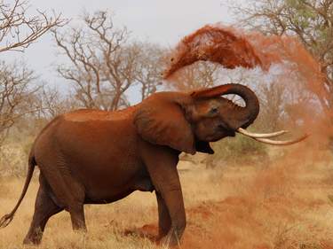
Fortunately, Malindi has some important saving graces. Number one is the coral reef south of the town centre. The combined Malindi/Watamu Marine National Park and Reserve encloses some of the best stretches on the coast, and the Malindi fish have become so used to humans that they swarm in front of your mask like a kaleidoscopic snowstorm. Malindi is also a game-fishing centre with regular competitions, and it’s also something of a surfing, windsurfing and kitesurfing resort, too. Good-sized rollers steam into the bay through the long break in the reef, opposite the town, between June and late September, whipped up by the southerly monsoon (kusi) wind. The surfing isn’t world class, but it’s fun, and good enough for boogie boards.

Meanwhile, an interesting old Swahili quarter, one or two historical sites, a busy market, shops, hotelis and plenty of lodgings just about manage to balance out the tourist boutiques, beauty salons and real-estate agencies. As for the Italian influence, the new resident expats have brought the town riches that nowhere else in Kenya can boast – and some of the best pizzas, pasta and ice cream in the whole of Africa.

Malindi’s beaches

The beach near the town centre, several hundred metres east of Lamu Road, is windswept and less appealing than you might imagine. For more of a seaside atmosphere, the seafront Vasco da Gama Road further south is pleasant, especially in the late afternoon. For the real McCoy, beach-wise, you need to go further south of the town centre to the aptly named Silversands Beach, complete with its reef-fringed lagoon, palm trees and inevitable beach boys.

Sea and water conditions in Malindi

Malindi’s shoreline can get very windy around September, and during June, July and November the beach becomes covered in seaweed – many hotels clear their beachfronts daily, though the seaweed is clean and perfectly harmless, and in fact prevents erosion of the beach (clearing it is prohibited within the limits of the marine park). It’s also worth knowing that the headland of Vasco da Gama Point marks a locally important division. To the north, the sea water is often reddish-brown and cloudy – full of the soil erosion brought down by the Galana (Sabaki) River, especially after rain – and, to the south, the Marine Park encloses a zone of often aquarium-clear water.

The Tana Delta

North out of Malindi, the road to Lamu sets off as a tarmac highway, crosses the Sabaki (Galana) River and passes one or two resort developments and the anachronistic little seaside town of MAMBRUI, with its pretty mosque, semi-ruined pillar tomb and the unusual spectacle of cows on the beach. The idyllic kitesurfing base of Che Shale is further up the coast on the south side of the Ras Ngomeni peninsula. About 60km north of Malindi, you leave the shambas and scattered homesteads behind and enter the bush of the Tana Delta, with the road arrowing straight across the flat, gentle landscape, brown and arid, or grey-green and swampy, depending on the season.

The former ferry-crossing town of Garsen has been sidelined by the tarmac New Garsen Causeway, which sweeps over the Tana River 7km to the south of the flyblown town before petering out into a dirt track after you reach Witu. Garsen has a KCB bank with an ATM and, in season, some of the best and cheapest mangoes in Kenya.

Between the river and the end of the trip, the scenery can pall, but if you’re on the bus, the journey is always enlivened by the other passengers and by stops at various small Tana delta towns and villages. Occasional flashes of colour – the sky-blue cloaks of Orma herders or the red, black and white of shawled Somali women – break up the journey, along with wonderful birdlife and some big game, too: especially giraffe and antelope (notably waterbuck), and even the odd elephant if you look hard enough. The road passes right through the Kipini sanctuary.

Note that parts of this area were severely affected by ethnic violence in 2012, 2013 and 2014 (see Trouble in the delta); at the time of writing most government travel advisories were still warning travellers to avoid it.

Trouble in the delta

Despite progress at the micro level with initiatives like those of Delta Dunes Lodge and the Lower Tana Delta Trust, the threats to the Tana Delta region seem to be accumulating. After the failure of a highly damaging irrigation and rice-growing project in the 1990s, the latest, environmentally disastrous, idea is a gigantic biofuel project, that would carpet more than 200 square kilometres of bush and flood land with sugar-cane plantations for cheap ethanol – plans that may not be entirely prevented by the delta being recently put under international protection as Kenya’s sixth Ramsar Site – a wetlands area of global importance.

Competition for scarce resources is also pitching communities against each other: in 2012 and 2013, more than one hundred people from the pastoralist Orma and farming Pokomo communities were killed in alternate raids on each other’s villages, sparked by disputes over water and grazing rights. There were fresh attacks in 2014, when gunmen claiming to be part of the Islamist group Al-Shabaab attacked a passenger bus and several villages in Tana River and Lamu counties, killing 87 people. Though no foreign visitors were affected, travel advisories were still warning against visiting the region as this book went to print and if you’re travelling by private vehicle, the police may require you to travel in convoy anywhere east of Garsen. Wherever you are hoping to visit, it’s a good idea to seek local advice before attempting an independent excursion to the area.

Watamu

WATAMU can at first sight seem a bit superficial, consisting simply of a small agglomeration of hotels, a strip of beachfront private homes, a compact village shaded by coconut trees, and the beach. There are good reasons to come here, however, including the superb marine park, some interesting wildlife initiatives, youthful nightlife (sporadically) and the beautiful beach itself. Watamu is comfortable with tourists, and despite tourism’s high profile, there’s a discernibly easier-going atmosphere here than at Diani, Malindi or along Mombasa’s north coast. As most of the beach is within the marine park, KWS regulations tend to be more strictly enforced to keep hawkers away.

This is an exceptional shoreline, with three stunning bays – Watamu Bay, the Blue Lagoon and Turtle Bay – separated by raised coral cliffs and dotted with tiny, sculpted coral islets. Watamu is good for diving – and a good place to get qualified, with several diving schools. Out in the Watamu Marine National Park, when the visibility is good, the submerged crags of living coral gardens and their swirls of brilliant fish are still magically vivid, although like elsewhere they are suffering from contact damage and the steady rise in sea temperature.

Planning your own trip? Prepare for your trip

Use Rough Guides' trusted partners for great rates

Rough Guides Editors

written by Rough Guides Editors

updated 26.04.2021

Ready to travel and discover
Kenya?

Get support from our local experts for
stress-free planning & worry-free travels

Plan my trip ⤍